Approximate Location Map
Large Map »
Latitude: 51.8614 / 51°51'41"N
Longitude: -0.1176 / 0°7'3"W
OS Eastings: 529722
OS Northings: 219766
OS Grid: TL297197
Mapcode National: GBR K9X.73N
Mapcode Global: VHGP7.XG6W
Plus Code: 9C3XVV6J+HX
Entry Name: Bridge over River Beane
Listing Date: 11 June 1986
Grade: II
Source: Historic England
Source ID: 1089075
English Heritage Legacy ID: 356310
ID on this website: 101089075
Location: Watton at Stone, East Hertfordshire, SG14
County: Hertfordshire
District: East Hertfordshire
Civil Parish: Watton-at-Stone
Built-Up Area: Watton at Stone
Traditional County: Hertfordshire
Lieutenancy Area (Ceremonial County): Hertfordshire
Church of England Parish: Watton-at-Stone
Church of England Diocese: St.Albans
Tagged with: Bridge
WATTON-AT-STONE WALKERN ROAD
TL 21 NE
Watton-at-Stone
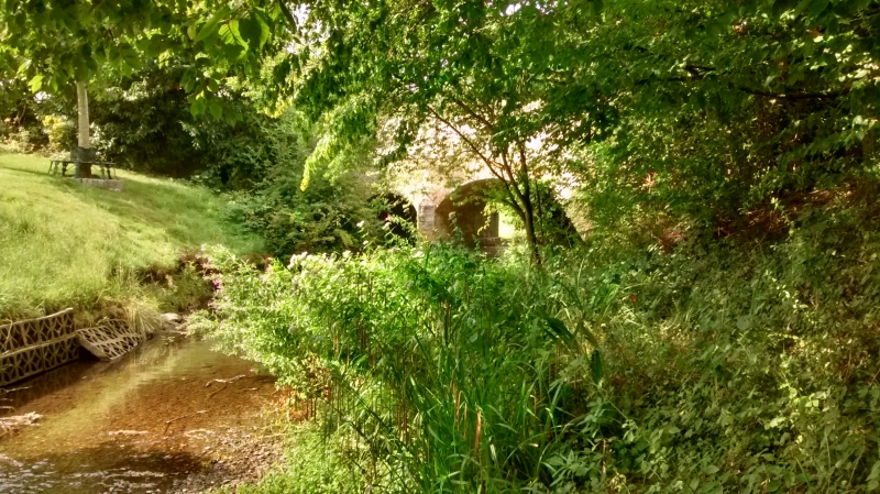
3/200 Bridge over River Beane
-
- II
Road bridge. c.1830. Caleb Hitch's patent brick with some later stock
brick repair. Stone dressings. Triple segmental arch, that to centre
larger. Stone capped cutwaters to both sides. Slightly splayed to banks
over outer arches. Pilaster strips on parapets at angles of splays. End
piers with moulded stone caps. Curved abutment walls at ends. Bands to
parapets, that to E largely rebuilt. Segmental brick coping to parapets.
Hitch bricks, patented in 1828, are 1 foot long by 6 inches wide and 6
inches deep with interlocking flanges and resemble rat-trap bond.
(W Branch Johnson, Industrial Archaeology of Hertfordshire, 1970).
Listing NGR: TL2972219766
External links are from the relevant listing authority and, where applicable, Wikidata. Wikidata IDs may be related buildings as well as this specific building. If you want to add or update a link, you will need to do so by editing the Wikidata entry.


Other nearby listed buildings
