Latitude: 51.6578 / 51°39'28"N
Longitude: -2.0005 / 2°0'1"W
OS Eastings: 400058
OS Northings: 195445
OS Grid: SU000954
Mapcode National: GBR 2QB.502
Mapcode Global: VHB2X.8LRH
Plus Code: 9C3VMX5X+4Q
Entry Name: Cross
Listing Date: 27 February 1986
Grade: II
Source: Historic England
Source ID: 1089252
English Heritage Legacy ID: 129371
ID on this website: 101089252
Location: Poole Keynes, Cotswold, Gloucestershire, GL7
County: Gloucestershire
District: Cotswold
Civil Parish: Poole Keynes
Traditional County: Wiltshire
Lieutenancy Area (Ceremonial County): Gloucestershire
Church of England Parish: Poole Keynes St Michael and All Angels
Church of England Diocese: Gloucester
Tagged with: Architectural structure High cross
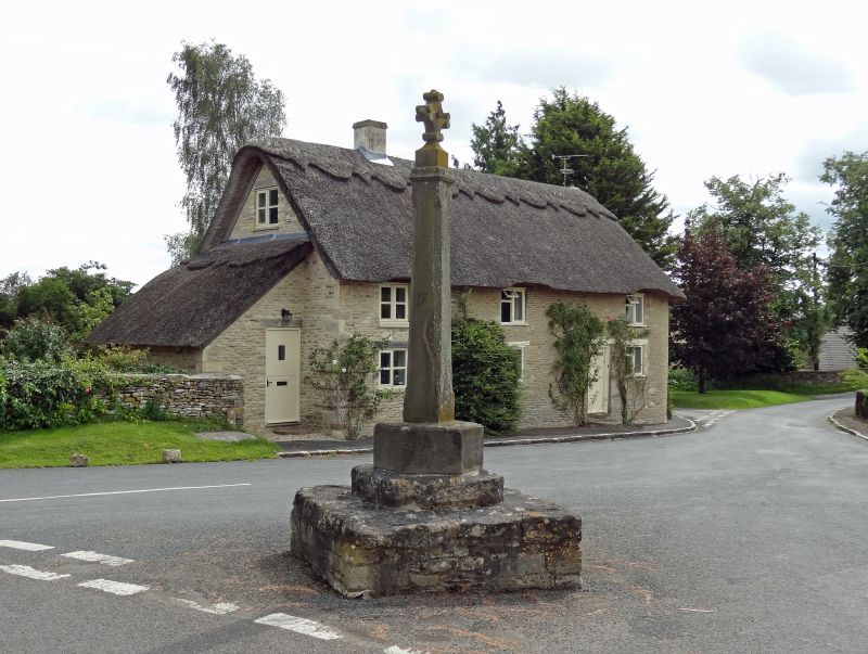
POOLE KEYNES POOLE KEYNES VILLAGE
SU 09 NW
at NGR 00069542
8/74 Cross
GV II
Village cross. Base probably medieval, shaft of C19. Large square
rubble stone base with smaller square plinth supporting hexagonal
base of a single chamfered square stone shaft. Arms of cross
missing.
Listing NGR: SU0006295444
External links are from the relevant listing authority and, where applicable, Wikidata. Wikidata IDs may be related buildings as well as this specific building. If you want to add or update a link, you will need to do so by editing the Wikidata entry.


Other nearby listed buildings