Latitude: 51.6698 / 51°40'11"N
Longitude: -1.9644 / 1°57'51"W
OS Eastings: 402559
OS Northings: 196777
OS Grid: SU025967
Mapcode National: GBR 3RJ.85W
Mapcode Global: VHB2X.W9W9
Plus Code: 9C3WM29P+W6
Entry Name: Manor Farmhouse
Listing Date: 27 February 1986
Grade: II
Source: Historic England
Source ID: 1090080
English Heritage Legacy ID: 129493
ID on this website: 101090080
Location: Shorncote, Cotswold, Gloucestershire, GL7
County: Gloucestershire
District: Cotswold
Civil Parish: Somerford Keynes
Traditional County: Wiltshire
Lieutenancy Area (Ceremonial County): Gloucestershire
Church of England Parish: Somerford Keynes with Sharncote All Saints
Church of England Diocese: Gloucester
Tagged with: Farmhouse
SOMERFORD KEYNES SHORNCOTE SU 09 NW 8/194 Manor Farmhouse
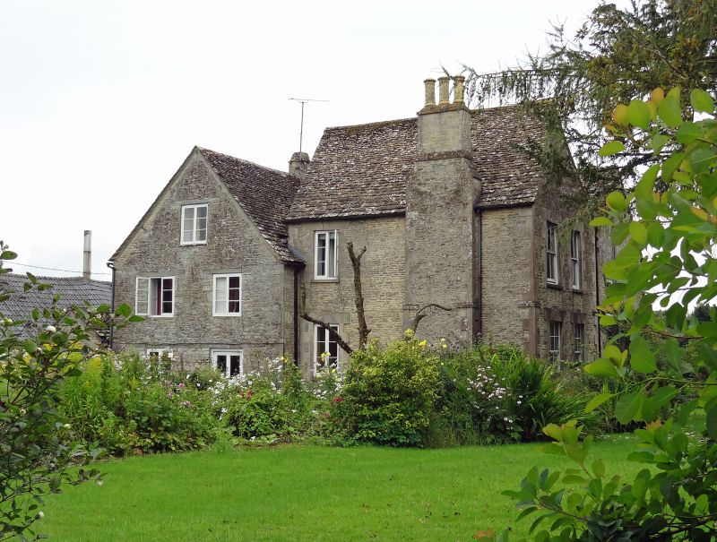
GV II Large farmhouse. Probably early C18 enlarged with rear range in early C19. Random coursed rubble stone, stone slate roof, stone end stack to right and ridge stack to left of centre. Double range with right-hand rear range at right angles, left-hand parallel. Two storeys. Front has 3 windows, 3-light wood casements with large flush stone lintels. On ground floor, large timber lintel to left with C20 glazed double doors and single light, two wide 6-pane sashes flanking large projecting gabled ashlar porch up 2 steps with very large stone lintel and keystone and half-glazed C19 door to rear with coloured margin glazing. Internal shutters visible on ground floor. Left-hand return of rear range on plinth with quoins, with 2 sashes to each floor with quoin surrounds and keystone, all flush on first floor and slightly raised on ground floor. Rear external stack with decorative flues. Interior not inspected.
Listing NGR: SU0255996777
External links are from the relevant listing authority and, where applicable, Wikidata. Wikidata IDs may be related buildings as well as this specific building. If you want to add or update a link, you will need to do so by editing the Wikidata entry.


Other nearby listed buildings