Latitude: 51.7745 / 51°46'28"N
Longitude: -2.2906 / 2°17'26"W
OS Eastings: 380046
OS Northings: 208470
OS Grid: SO800084
Mapcode National: GBR 0KR.PPJ
Mapcode Global: VH94Q.7NXH
Plus Code: 9C3VQPF5+RQ
Entry Name: Church House
Listing Date: 10 January 1955
Last Amended: 9 December 1986
Grade: II
Source: Historic England
Source ID: 1091336
English Heritage Legacy ID: 132506
ID on this website: 101091336
Location: St Nicholas's Church, Standish, Stroud, Gloucestershire, GL10
County: Gloucestershire
District: Stroud
Civil Parish: Standish
Traditional County: Gloucestershire
Lieutenancy Area (Ceremonial County): Gloucestershire
Church of England Parish: Standish St Nicholas
Church of England Diocese: Gloucester
Tagged with: House Seat of local government
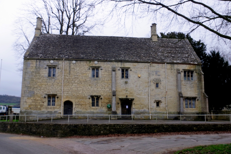
STANDISH STANDISH VILLAGE SO 80 NW 7/247 Church House (formerly listed as The School) 10.1.55 GV II Probable former almonry, used as church house, school, now village hall with offices of Gloucestershire Trust for Nature Conservation. C16, on core possibly of C14, possibly built in 2 stages, restored c1844. Random coursed and dressed stone, stone slate roof, with coped verges and ashlar stacks of C19 with twin diagonally set flues to ridge and north end. Single long range of 2 storeys and attic, with stepped buttresses to south end only, from approximately halfway along length. Arched light stone mullioned windows with square hoodmoulds, mostly 2-light on west side, and 3- light on east side. Some replaced or inserted windows of C19 and C20. Five window bays to each side, two C19 three-light gabled dormers to east. North end has chamfered pointed arch doorway on each side, south end has 4-centred archway with enriched spandrels and square hoodmould to each side. On east side at north end a blocked doorway with very large flush stone lintel, possibly from original structure of which some walling appears to be incorporated in north gable end wall. Interior much altered in C19 but retains one 4-centred archway on left of similar doorway on west side, possibly originally an external doorway. (VCH, Gloucestershire, Vol X, 1972)
Listing NGR: SO8007908416
External links are from the relevant listing authority and, where applicable, Wikidata. Wikidata IDs may be related buildings as well as this specific building. If you want to add or update a link, you will need to do so by editing the Wikidata entry.


Other nearby listed buildings