Latitude: 51.786 / 51°47'9"N
Longitude: -2.1946 / 2°11'40"W
OS Eastings: 386673
OS Northings: 209724
OS Grid: SO866097
Mapcode National: GBR 1M0.XNJ
Mapcode Global: VH94R.XC5P
Plus Code: 9C3VQRP4+C5
Entry Name: Town Hall
Listing Date: 24 August 1990
Grade: II
Source: Historic England
Source ID: 1091564
English Heritage Legacy ID: 133544
ID on this website: 101091564
Location: Painswick, Stroud, Gloucestershire, GL6
County: Gloucestershire
District: Stroud
Civil Parish: Painswick
Built-Up Area: Painswick
Traditional County: Gloucestershire
Lieutenancy Area (Ceremonial County): Gloucestershire
Church of England Parish: Painswick St Mary the Virgin
Church of England Diocese: Gloucester
Tagged with: City hall Seat of local government
PAINSWICK VICTORIA STREET SO 8609 (part) (north side) 8/347 Town Hall GV II
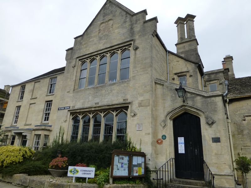
Town Hall. Dated 1840 in panel to gable; in good limestone ashlar with plain tile roof. In C19 Tudor style. Set gable to street, and stands forward from adjoining building to right. Saddle-back coped gable to double stepped kneelers over a quatrefoil commemorative panel. Below this 5-light hollow chamfer case- ments with pointed heads to lights and with square stopped hood at ground and first floors above a moulded offset plinth. To the right a single storey lean- to with plank door in moulded surround at head of 4 steps; behind this a swept- down extension with prominent stack having 2 separated flues set diagonally and capped. Interior: simple work in original detail. The building replaced an earlier town hall, opposite, which was demolished in 1840. From 1844 to 1867 an upper room in the new building, then known as Stock House, was an Endowed School.
Listing NGR: SO8668209723
External links are from the relevant listing authority and, where applicable, Wikidata. Wikidata IDs may be related buildings as well as this specific building. If you want to add or update a link, you will need to do so by editing the Wikidata entry.


Other nearby listed buildings