Latitude: 50.9068 / 50°54'24"N
Longitude: -1.4012 / 1°24'4"W
OS Eastings: 442199
OS Northings: 112097
OS Grid: SU421120
Mapcode National: GBR RR2.FZ
Mapcode Global: FRA 76YQ.3XM
Plus Code: 9C2WWH4X+PG
Entry Name: 30 and 31, Palmerston Road
Listing Date: 14 February 1969
Grade: II
Source: Historic England
Source ID: 1092031
English Heritage Legacy ID: 135876
ID on this website: 101092031
Location: Kingsland Place, Southampton, Hampshire, SO14
County: City of Southampton
Electoral Ward/Division: Bargate
Parish: Non Civil Parish
Built-Up Area: Southampton
Traditional County: Hampshire
Lieutenancy Area (Ceremonial County): Hampshire
Church of England Parish: Southampton City Centre St Mary
Church of England Diocese: Winchester
Tagged with: Building
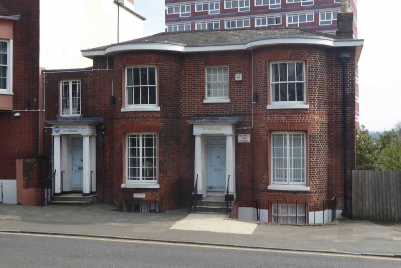
1. PALMERSTON ROAD
5239
Nos 30 and 31
SU 4212 2/184 14.2.69
II GV
2.
Early C19 pair. Two parallel ranges. Two storeys brick with slate roof.
Flat eaves cornice. Four sashes, alternate windows in 2 storey segmental
bows. Left-hand doors with fluted Doric porticos.
Listing NGR: SU4220212094
External links are from the relevant listing authority and, where applicable, Wikidata. Wikidata IDs may be related buildings as well as this specific building. If you want to add or update a link, you will need to do so by editing the Wikidata entry.


Other nearby listed buildings