Approximate Location Map
Large Map »
Latitude: 51.1666 / 51°9'59"N
Longitude: -1.4423 / 1°26'32"W
OS Eastings: 439093
OS Northings: 140963
OS Grid: SU390409
Mapcode National: GBR 736.VJW
Mapcode Global: VHC2Z.YYD2
Plus Code: 9C3W5H85+J3
Entry Name: Rodsway and Attached Barn
Listing Date: 20 December 1960
Grade: II
Source: Historic England
Source ID: 1093372
English Heritage Legacy ID: 139719
ID on this website: 101093372
Location: Wherwell, Test Valley, Hampshire, SP11
County: Hampshire
District: Test Valley
Civil Parish: Wherwell
Built-Up Area: Wherwell
Traditional County: Hampshire
Lieutenancy Area (Ceremonial County): Hampshire
Church of England Parish: Wherwell St Peter and Holy Cross
Church of England Diocese: Winchester
Tagged with: Building Thatched cottage
3940 WHERWELL CHURCH STREET
20-12-60
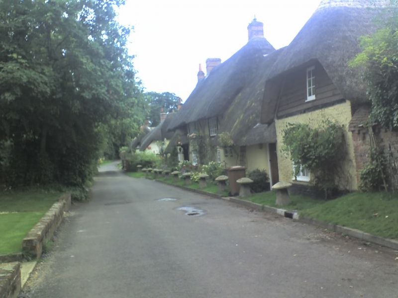
9/26 Rodsway, and attached
Barn.
GV II
House and small barn or stable. C17, with C19 details. Plastered walls
and thatched roof. 1 storey and attic, 3 windows. The roof is lowered
as a hip at each end over outshots and continues as a capping to a short wall,
linked to the ½-hipped barn roof. There is a high plinth and the wall
(to the barn) has a doorway, the barn is boarded above rubble brick and flint
at the front, the other sides being boarded. Casements. Cl9 doorway with
a hood on brackets (now with a thatched cover), pilasters, and 6-panelled
(2-top-glazed) door.
Listing NGR: SU3913140918
External links are from the relevant listing authority and, where applicable, Wikidata. Wikidata IDs may be related buildings as well as this specific building. If you want to add or update a link, you will need to do so by editing the Wikidata entry.


Other nearby listed buildings
