Approximate Location Map
Large Map »
Latitude: 51.1515 / 51°9'5"N
Longitude: -0.9713 / 0°58'16"W
OS Eastings: 472048
OS Northings: 139636
OS Grid: SU720396
Mapcode National: GBR C9B.M8L
Mapcode Global: VHDYC.3BW4
Plus Code: 9C3X522H+HF
Entry Name: 47, Normandy Street
Listing Date: 31 March 1977
Grade: II
Source: Historic England
Source ID: 1094140
English Heritage Legacy ID: 141881
ID on this website: 101094140
Location: Spitalhatch, East Hampshire, GU34
County: Hampshire
District: East Hampshire
Civil Parish: Alton
Built-Up Area: Alton
Traditional County: Hampshire
Lieutenancy Area (Ceremonial County): Hampshire
Church of England Parish: The Resurrection Alton
Church of England Diocese: Winchester
Tagged with: Building
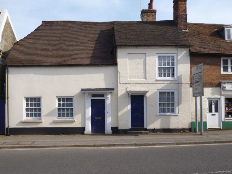
NORMANDY STREET
1.
5236
(South East Side)
No 47
SU 7239 3/3
II GV
2.
Circa 1800. 2 storeys; 2 bays. Painted brick; tile roof. Ground floor with
6-panelled door beneath simple hood and flush sash window. 1st floor with one
blank and one flush sash window.
Nos 43 and 45 together with No 47 form a group.
External links are from the relevant listing authority and, where applicable, Wikidata. Wikidata IDs may be related buildings as well as this specific building. If you want to add or update a link, you will need to do so by editing the Wikidata entry.


Other nearby listed buildings
