Latitude: 51.0892 / 51°5'21"N
Longitude: -0.7978 / 0°47'52"W
OS Eastings: 484293
OS Northings: 132900
OS Grid: SU842329
Mapcode National: GBR DCN.P3M
Mapcode Global: FRA 9667.R0P
Plus Code: 9C3X36Q2+MV
Entry Name: Table Tomb 4 Metres East of Chancel
Listing Date: 23 January 1986
Grade: II
Source: Historic England
Source ID: 1094482
English Heritage Legacy ID: 143097
ID on this website: 101094482
Location: St Mary's Church, Bramshott, East Hampshire, GU30
County: Hampshire
District: East Hampshire
Town: East Hampshire
Civil Parish: Bramshott and Liphook
Traditional County: Hampshire
Lieutenancy Area (Ceremonial County): Hampshire
Church of England Parish: Bramshott and Liphook St Mary the Virgin
Church of England Diocese: Portsmouth
Tagged with: Tomb
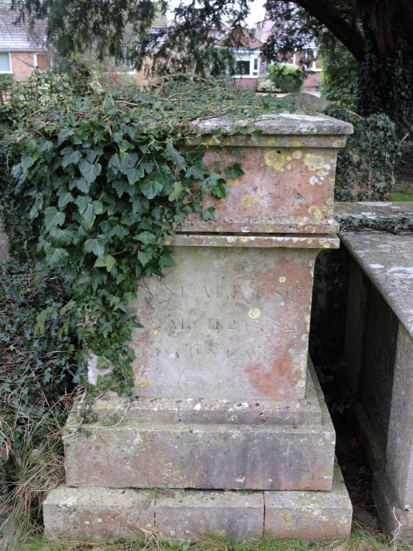
BRAMSHOTT & LIPHOOK CHURCH ROAD SU 83 SW Bramshott 6/15 Table tomb 4 metres east of chancel 23/01/86 II Table tomb. 1829. Stone rectangular tomb with severely-simple treatment of thin mouldings, the upper stage overhanging the lower. Inscription refers to Neale, with the date 24 March 1829.
Listing NGR: SU8422332852
External links are from the relevant listing authority and, where applicable, Wikidata. Wikidata IDs may be related buildings as well as this specific building. If you want to add or update a link, you will need to do so by editing the Wikidata entry.


Other nearby listed buildings