Latitude: 51.0612 / 51°3'40"N
Longitude: -1.3177 / 1°19'3"W
OS Eastings: 447909
OS Northings: 129314
OS Grid: SU479293
Mapcode National: GBR 861.HMS
Mapcode Global: FRA 8649.SKH
Plus Code: 9C3W3M6J+FW
Entry Name: 33-39, Southgate Street
Listing Date: 14 January 1974
Grade: II
Source: Historic England
Source ID: 1095370
English Heritage Legacy ID: 144836
ID on this website: 101095370
Location: The Close, Winchester, Hampshire, SO23
County: Hampshire
District: Winchester
Electoral Ward/Division: St Michael
Parish: Non Civil Parish
Built-Up Area: Winchester
Traditional County: Hampshire
Lieutenancy Area (Ceremonial County): Hampshire
Church of England Parish: Winchester St Lawrence with St Swithun-upon-Kingsgate
Church of England Diocese: Winchester
Tagged with: Building
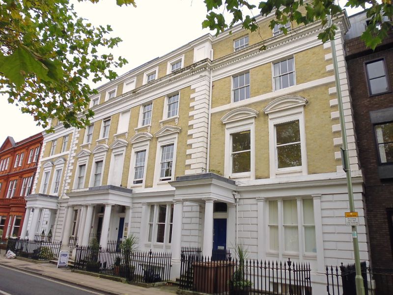
SOUTHGATE STREET 1. 1833 (East Side) Nos 33 to 39 (odd) SU 4729 SE 5/291 II GV 2. Mid C19. Four storeys, yellow-grey brick. 2-5-2 windows centre projecting with quoins. Stucco dressings. Rusticated stucco ground floor with 3-light sashes divided by mullions, cornice over. First floor windows stucco architrave surrounds and segmental or triangular pediments. Second floor windows in centre with bracketted cills - the outer windows with 2 cill bands. Heavy entablature with dentilled cornice over. The top storey is an attic, the central part has windows in stucco surrounds. Cornice over and panelled coner piers. Iron area railing. The houses originally had stucco porches now missing, but the pilasters survive. No 39 has no glazing bars and the brick work has been raddled. Graded for group value. All the listed buildinas on the east side of Southgate Street form a group.
Listing NGR: SU4791529323
External links are from the relevant listing authority and, where applicable, Wikidata. Wikidata IDs may be related buildings as well as this specific building. If you want to add or update a link, you will need to do so by editing the Wikidata entry.


Other nearby listed buildings