Approximate Location Map
Large Map »
Latitude: 51.0618 / 51°3'42"N
Longitude: -1.3201 / 1°19'12"W
OS Eastings: 447740
OS Northings: 129381
OS Grid: SU477293
Mapcode National: GBR 861.9AP
Mapcode Global: FRA 8639.ZFC
Plus Code: 9C3W3M6H+PX
Entry Name: Peninsular Barracks East Block
Listing Date: 14 January 1974
Grade: II
Source: Historic England
Source ID: 1095405
English Heritage Legacy ID: 144732
ID on this website: 101095405
Location: The Close, Winchester, Hampshire, SO23
County: Hampshire
District: Winchester
Electoral Ward/Division: St Michael
Parish: Non Civil Parish
Built-Up Area: Winchester
Traditional County: Hampshire
Lieutenancy Area (Ceremonial County): Hampshire
Church of England Parish: Winchester St Lawrence with St Swithun-upon-Kingsgate
Church of England Diocese: Winchester
Tagged with: Building
ROMSEY ROAD
1.
1833
(South Side)
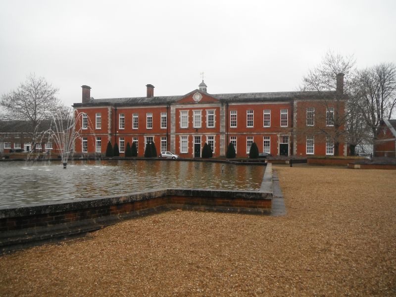
Peninsular Barracks
East Block
SU 4729 SE 5/398
II GV
2.
Circa 1900. As other blocks but two storeys, fifteen bays and one pediment.
The buildings of Peninsular Barracks form a group.
Listing NGR: SU4771429457
External links are from the relevant listing authority and, where applicable, Wikidata. Wikidata IDs may be related buildings as well as this specific building. If you want to add or update a link, you will need to do so by editing the Wikidata entry.


Other nearby listed buildings
