Latitude: 52.8116 / 52°48'41"N
Longitude: -1.4799 / 1°28'47"W
OS Eastings: 435155
OS Northings: 323907
OS Grid: SK351239
Mapcode National: GBR 6G6.QNK
Mapcode Global: WHDHD.7LKF
Plus Code: 9C4WRG6C+J3
Entry Name: The Lock-Up
Listing Date: 19 January 1967
Grade: II*
Source: Historic England
Source ID: 1096445
English Heritage Legacy ID: 82926
ID on this website: 101096445
Location: Ticknall, South Derbyshire, DE73
County: Derbyshire
District: South Derbyshire
Civil Parish: Ticknall
Built-Up Area: Ticknall
Traditional County: Derbyshire
Lieutenancy Area (Ceremonial County): Derbyshire
Church of England Parish: Ticknall St George
Church of England Diocese: Derby
Tagged with: Architectural structure Village lock-up
PARISH OF TICKNALL MAIN STREET
SK 32 SE
4/119
(Highwayside)
19-1-67 (North Side)
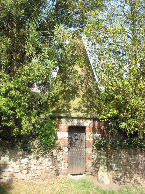
The Lock-Up
GV
II*
Lock-up. Late C18. Red brick with sandstone dressings. Small
octagonal structure with a doorway to south with stone lintel
and jambs. Studded plank door. Chamfered stringcourse at the
base of the octagonal brick spire. The interior has a
fireplace.
Listing NGR: SK3515523907
External links are from the relevant listing authority and, where applicable, Wikidata. Wikidata IDs may be related buildings as well as this specific building. If you want to add or update a link, you will need to do so by editing the Wikidata entry.


Other nearby listed buildings