Latitude: 50.5952 / 50°35'42"N
Longitude: -2.4608 / 2°27'38"W
OS Eastings: 367482
OS Northings: 77372
OS Grid: SY674773
Mapcode National: GBR PY.FFJP
Mapcode Global: FRA 57QH.K4V
Plus Code: 9C2VHGWQ+3M
Entry Name: Sandsfoot Castle Remains
Listing Date: 12 December 1953
Grade: II*
Source: Historic England
Source ID: 1096763
English Heritage Legacy ID: 467774
ID on this website: 101096763
Location: Sandsfoot Castle Gardens, Southlands, Dorset, DT4
County: Dorset
Electoral Ward/Division: Weymouth East
Parish: Weymouth
Built-Up Area: Weymouth
Traditional County: Dorset
Lieutenancy Area (Ceremonial County): Dorset
Church of England Parish: Weymouth Holy Trinity
Church of England Diocese: Salisbury
Tagged with: Castle Fort Device Fort
WEYMOUTH
SY67NE OLD CASTLE ROAD 873-1/4/242 (East side) 12/12/53 Sandsfoot Castle, remains
II*
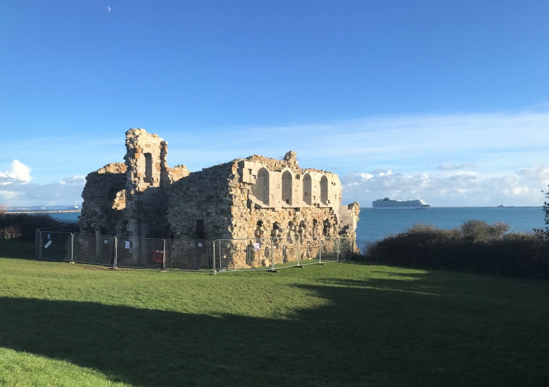
Coastal fort, now ruined. c1541. For Henry VIII. Portland rubble core with remains of ashlar in parts. One of Henry VIII's coastal forts, built at a cost of »3887-4s-1d. PLAN: originally a central block of 2 storeys and basement, with NW entrance gate, and an octagonal gun-room on the seaward side. The outer walls with gatehouse remain in part, much decayed, but the gun-room has practically disappeared through coastal erosion. EXTERIOR: the entry front has remains of the left side of the gatehouse over an entry with straight-sided low arch, with remains of walling each side, unfaced. The right side has remains of walling to basement, ground and first floors, with substantial ashlar remnants to the upper level with 4 large openings to deep reveals on 4-centred heads over square openings, and very steep sloping sills. Beneath, in unfaced walling, are 6 lights to peaked heads, with 5 square-headed openings to the basement. The opposite flank has 4 deep casements, in some ashlar facing, above 4 openings to the main level; the basement level is below ground level on this side. INTERIOR: is completely unroofed and without floors or fittings except for remains of a fireplace and doorways at the seaward end. HISTORICAL NOTE: the building suffered early erosion, already referred to in 1584, was abandoned for military use in 1644-5, and used as a store until 1691. It has importance as one of the coastal defences built for Henry VIII; the corresponding Portland Castle (see Portland) is still complete. RCHME has drawings of the ruins (p.337). (RCHME: Dorset, South-East: London: 1970-: 336-337).
Listing NGR: SY6748277372
External links are from the relevant listing authority and, where applicable, Wikidata. Wikidata IDs may be related buildings as well as this specific building. If you want to add or update a link, you will need to do so by editing the Wikidata entry.


Other nearby listed buildings