Latitude: 50.4993 / 50°29'57"N
Longitude: -3.587 / 3°35'13"W
OS Eastings: 287540
OS Northings: 67817
OS Grid: SX875678
Mapcode National: GBR QS.FVG0
Mapcode Global: FRA 37CQ.Y3S
Plus Code: 9C2RFCX7+P5
Entry Name: Ruins of Manor House Circa 40 Metres West-North-West of Church of St Mary
Listing Date: 23 August 1955
Grade: II
Source: Historic England
Source ID: 1097293
English Heritage Legacy ID: 84871
ID on this website: 101097293
Location: Kingskerswell, Teignbridge, Devon, TQ12
County: Devon
District: Teignbridge
Civil Parish: Kingskerswell
Built-Up Area: Kingskerswell
Traditional County: Devon
Lieutenancy Area (Ceremonial County): Devon
Church of England Parish: Kingskerswell St Mary
Church of England Diocese: Exeter
Tagged with: Building
SX 86 NE
3/160
23.8.55
KINGSKERSWELL
CHURCH END ROAD (west side),
Kingskerswell
Ruins of Manor House circa 40 metres west-north-west of Church of St Mary
GV
II
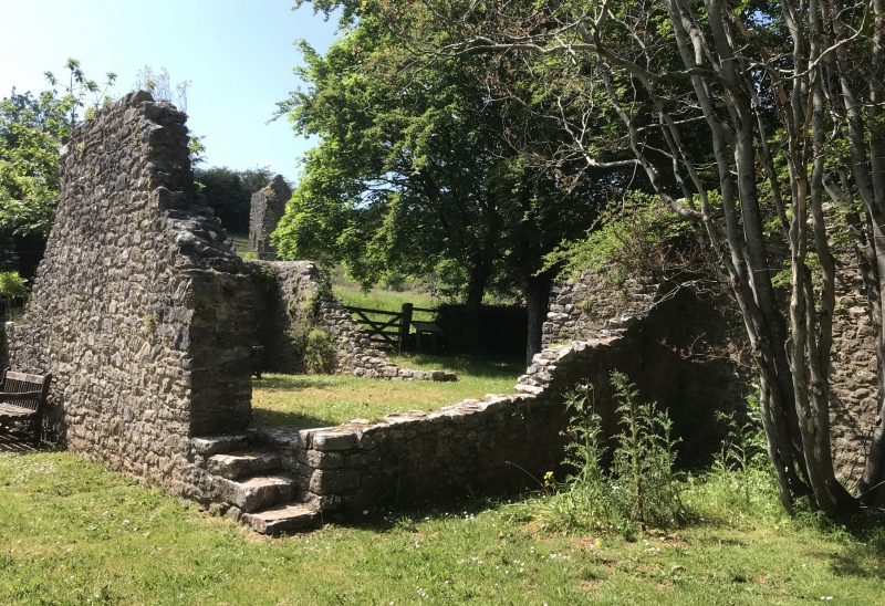
Ruins of manor house reputedly of the Dinham family. Probably medieval.
Fragmentary rubble walls and remains of tower with dressed granite jambs to doorway
and fallen head of arch. Considerably obscured by foliage.
Listing NGR: SX8754067817
External links are from the relevant listing authority and, where applicable, Wikidata. Wikidata IDs may be related buildings as well as this specific building. If you want to add or update a link, you will need to do so by editing the Wikidata entry.


Other nearby listed buildings