Latitude: 50.6812 / 50°40'52"N
Longitude: -3.2458 / 3°14'44"W
OS Eastings: 312079
OS Northings: 87581
OS Grid: SY120875
Mapcode National: GBR P8.BR31
Mapcode Global: FRA 4728.R9J
Plus Code: 9C2RMQJ3+FM
Entry Name: Drinking Fountain
Listing Date: 12 November 1973
Grade: II
Source: Historic England
Source ID: 1097964
English Heritage Legacy ID: 87298
ID on this website: 101097964
Location: Cotmaton, East Devon, EX10
County: Devon
District: East Devon
Civil Parish: Sidmouth
Built-Up Area: Sidmouth
Traditional County: Devon
Lieutenancy Area (Ceremonial County): Devon
Church of England Parish: Sidmouth
Church of England Diocese: Exeter
Tagged with: Drinking fountain
COTMATON ROAD
1.
1633
Drinking Fountain
SY 1287 1/59
II
2.
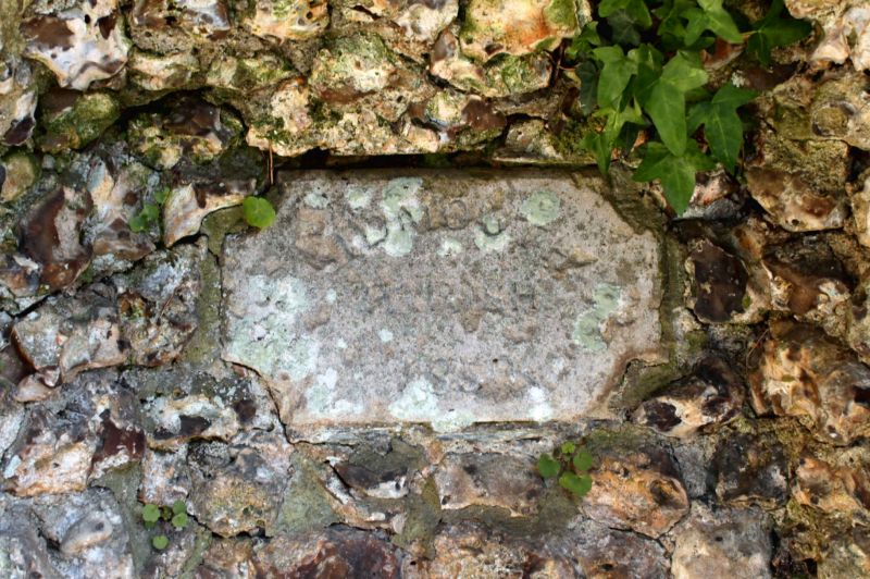
Wall niche in rustic flintwork. Shell pattern stone basin and very weathered
lion's head above. Tablet inscribed "Sidmouth Parish 1850".
Listing NGR: SY1207987581
External links are from the relevant listing authority and, where applicable, Wikidata. Wikidata IDs may be related buildings as well as this specific building. If you want to add or update a link, you will need to do so by editing the Wikidata entry.


Other nearby listed buildings