Latitude: 50.7661 / 50°45'58"N
Longitude: -3.4423 / 3°26'32"W
OS Eastings: 298381
OS Northings: 97272
OS Grid: SX983972
Mapcode National: GBR P2.Y5X1
Mapcode Global: FRA 37P2.0RC
Plus Code: 9C2RQH85+C3
Entry Name: Little Thatch Vine Cottage (With Little Thatch, School Lane)
Listing Date: 20 May 1985
Grade: II
Source: Historic England
Source ID: 1098304
English Heritage Legacy ID: 88446
ID on this website: 101098304
Location: Broadclyst, East Devon, EX5
County: Devon
District: East Devon
Civil Parish: Broad Clyst
Built-Up Area: Broadclyst
Traditional County: Devon
Lieutenancy Area (Ceremonial County): Devon
Church of England Parish: Broadclyst St John the Baptist
Church of England Diocese: Exeter
Tagged with: Building Thatched cottage
SX 99 NE BROADCLYST TOWN HILL, Broadclyst 9/133 Vine Cottage (with Little - Thatch, School Lane)
GV II
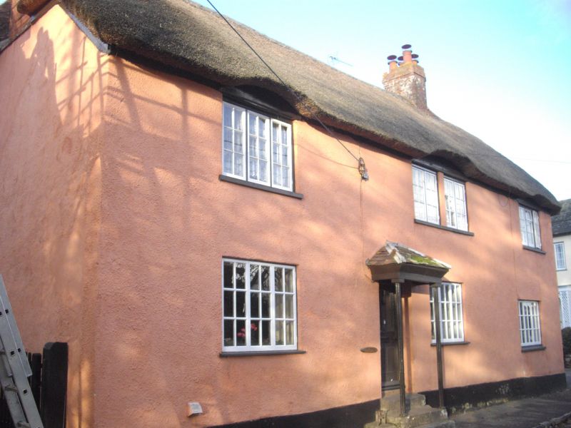
2 cottages. C17 with later additions. Cob, on stone plinth, rendered. Thatched roof over L-shaped plan, gabled-end to left-hand, hipped to right-hand (Town Hill front), the wing (to School Lane) gabled end to rear. The building may have been originally a 3-room, cross-passage house, the higher end to the right of doorway to Town Hill, with an inner room or parlour wing (now Little Thatch). Main front: one window to left of door, 2 to right, at ground level, all 3-light C20 timber casements. 4 C20 windows above, lintels at eaves level, the outer windows, 3-light timber casement, the 2 inner windows, set very close together and sharing the same sill, both 2-light. All casements 6 panes each. Doorway with little open porch hipped and resting on 2 fluted metal columns and approached by steps. Rear continuous outshut, flush with end gable of rear wing. School Lane elevation with one C20 window under eaves. Access by end door, under 2-light timber casement window. Curving rubble trap boundary wall at right. Included for group value.
Listing NGR: SX9838197272
External links are from the relevant listing authority and, where applicable, Wikidata. Wikidata IDs may be related buildings as well as this specific building. If you want to add or update a link, you will need to do so by editing the Wikidata entry.


Other nearby listed buildings