Approximate Location Map
Large Map »
Latitude: 52.1636 / 52°9'49"N
Longitude: -2.2452 / 2°14'42"W
OS Eastings: 383323
OS Northings: 251733
OS Grid: SO833517
Mapcode National: GBR 1GH.966
Mapcode Global: VH92T.1WD7
Plus Code: 9C4V5Q73+CW
Entry Name: Pump and Pumphouse
Listing Date: 9 February 1988
Grade: II
Source: Historic England
Source ID: 1098746
English Heritage Legacy ID: 153409
ID on this website: 101098746
Location: Powick Village, Malvern Hills, Worcestershire, WR2
County: Worcestershire
District: Malvern Hills
Civil Parish: Powick
Built-Up Area: Powick
Traditional County: Worcestershire
Lieutenancy Area (Ceremonial County): Worcestershire
Church of England Parish: Powick
Church of England Diocese: Worcester
Tagged with: Building
POWICK CP A 449
SO 85 SW
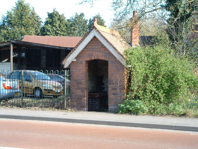
3/91 Pump and pumphouse
- II
Pump and pumphouse. Late C19. Brick with slate roof and cast iron pump.
The gable wall facing the road has a doorway with segmental arch and has
plain bargeboards. Interior: cast iron pump has broken handle and dis-
charges into earthenware sink.
Listing NGR: SO8332351733
External links are from the relevant listing authority and, where applicable, Wikidata. Wikidata IDs may be related buildings as well as this specific building. If you want to add or update a link, you will need to do so by editing the Wikidata entry.


Other nearby listed buildings
