Latitude: 51.9104 / 51°54'37"N
Longitude: -2.5445 / 2°32'40"W
OS Eastings: 362643
OS Northings: 223679
OS Grid: SO626236
Mapcode National: GBR FT.PTQ6
Mapcode Global: VH86J.V76V
Plus Code: 9C3VWF64+56
Entry Name: Weston Hall
Listing Date: 18 May 1953
Grade: II*
Source: Historic England
Source ID: 1099643
English Heritage Legacy ID: 155514
ID on this website: 101099643
Location: Weston under Penyard, County of Herefordshire, HR9
County: County of Herefordshire
Civil Parish: Weston under Penyard
Traditional County: Herefordshire
Lieutenancy Area (Ceremonial County): Herefordshire
Church of England Parish: Weston under Penyard
Church of England Diocese: Hereford
Tagged with: House
WESTON UNDER PENYARD CP A 40 SO 62 SW
5/98 Weston Hall
18.5.53
GV II*
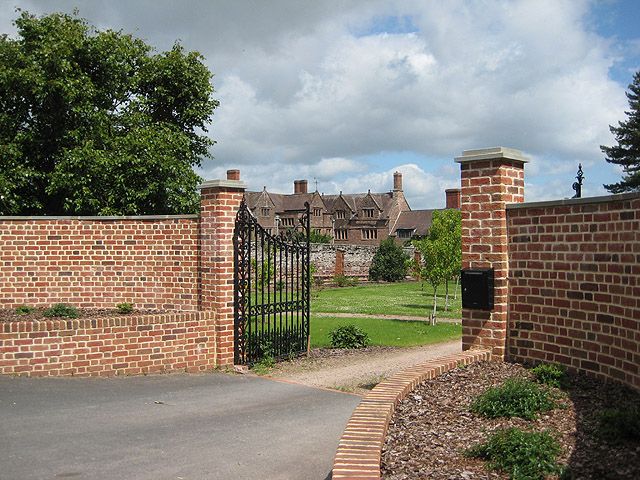
House. Circa 1600 with earlier remains. Squared sandstone rubble with tile roof. L-plan. Two storeys with attic. Main facade faces north-west and has two bays to each side of gabled porch. Two string courses. Windows, arranged symmetrically, are mullioned with rebate and ovolo moulding. Outer bays have two-storey canted bay windows, each with four lights at the front. Above, under gables, are 3-light attic windows. To each side of the porch there is a 2-light window on both floors. The first floor window of the porch is of three lights, the attic window of two. Above the round-headed doorway is a cartouche of arms and crest of Nourse. The gables are coped with ball finials. Chimneys to right of left-hand bay and projecting from right-hand return wall. The left-hand return wall has two strings, mullioned windows, and two gables with attic windows. Interior: not accessible at time of survey, but when recorded by RCHM had moulded ceiling beams, fire- places with moulded surrounds, and panelling. The south end of the south wing, at the right of the main facade, was said to contain the remains of a timber-framed building and to have a roof partly of C15 date. Formerly known as Lower Weston. (RCHM, p 211).
Listing NGR: SO6264323679
External links are from the relevant listing authority and, where applicable, Wikidata. Wikidata IDs may be related buildings as well as this specific building. If you want to add or update a link, you will need to do so by editing the Wikidata entry.


Other nearby listed buildings