Latitude: 51.976 / 51°58'33"N
Longitude: -2.7556 / 2°45'20"W
OS Eastings: 348197
OS Northings: 231109
OS Grid: SO481311
Mapcode National: GBR FJ.KP3V
Mapcode Global: VH861.6L3J
Plus Code: 9C3VX6GV+CQ
Entry Name: Churchyard Cross About 20 Yards West-South-West of the Tower of the Church of St David
Listing Date: 22 October 1986
Grade: II
Source: Historic England
Source ID: 1099675
English Heritage Legacy ID: 155382
ID on this website: 101099675
Location: St David's Church, Much Dewchurch, County of Herefordshire, HR2
County: County of Herefordshire
Civil Parish: Much Dewchurch
Traditional County: Herefordshire
Lieutenancy Area (Ceremonial County): Herefordshire
Church of England Parish: Much Dewchurch
Church of England Diocese: Hereford
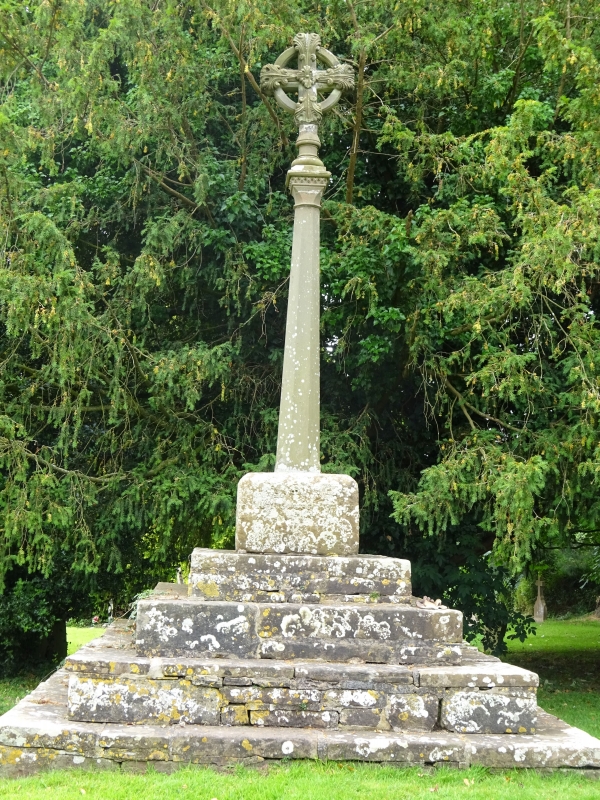
MUCH DEWCHURCH CP - SO 43 SE 6/82 21/4A Churchyard cross about 20 yards west-south-west of the tower of the Church of St David GV II
Churchyard cross. Possibly C14 or C15, restored by public subscription 1870. Sandstone ashlar and squared sandstone rubble. Four restored square steps rise to medieval base which has cinquefoil headed niche to each side. shaft and cross renewed. (RCHM, Vol I, p 50).
Listing NGR: SO4819531109


Other nearby listed buildings