Latitude: 51.9768 / 51°58'36"N
Longitude: -2.7553 / 2°45'19"W
OS Eastings: 348215
OS Northings: 231192
OS Grid: SO482311
Mapcode National: GBR FJ.KP4N
Mapcode Global: VH861.6K7Z
Plus Code: 9C3VX6GV+PV
Entry Name: Stone House
Listing Date: 20 October 1952
Grade: II
Source: Historic England
Source ID: 1167674
English Heritage Legacy ID: 155406
ID on this website: 101167674
Location: Much Dewchurch, County of Herefordshire, HR2
County: County of Herefordshire
Civil Parish: Much Dewchurch
Traditional County: Herefordshire
Lieutenancy Area (Ceremonial County): Herefordshire
Church of England Parish: Much Dewchurch
Church of England Diocese: Hereford
Tagged with: House
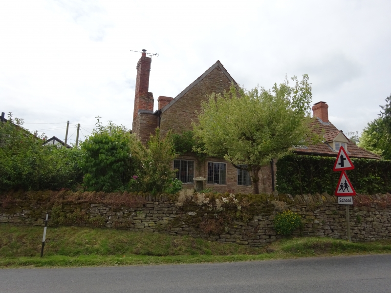
MUCH DEWCHURCH CP - SO 43 SE 6/106 Stone House 20.10.52 GV II House. Probably C16 and C17 with later extensions and alterations. Timber-frame and sandstone rubble with pantile roof and two sandstone rubble stacks with brick shafts. L-plan with main range aligned roughly east/west and cross-wing at east end. Two storeys. South elevation has 1:1 windows, one 2-light casement with brick head to left and one in extension to right of gable front. Two ledged doors to left and main entry to left of gable under lean-to canopy. North elevation has two early C20 gabled dormers each with a 2-light casement in main range. Gable to left has three 3-light late C19 casements, one to the first floor and two to the ground floor. Interior has cambered tie-beam to main range and collar trusses, one with a king-strut. Ground floor has ceiling beams with asymmetrical pyramidical stops, a blocked 4-centred doorway to south side of main range and adjacent exposed wall-framing. Stone House was formerly the Post Office. (RCHM, Vol I, p 51).
Listing NGR: SO4821831193
External links are from the relevant listing authority and, where applicable, Wikidata. Wikidata IDs may be related buildings as well as this specific building. If you want to add or update a link, you will need to do so by editing the Wikidata entry.


Other nearby listed buildings