Latitude: 52.007 / 52°0'25"N
Longitude: -2.8226 / 2°49'21"W
OS Eastings: 343629
OS Northings: 234604
OS Grid: SO436346
Mapcode National: GBR FF.HQH1
Mapcode Global: VH78C.1T49
Plus Code: 9C4V254G+QW
Entry Name: Thruxton Court
Listing Date: 29 September 1952
Grade: II
Source: Historic England
Source ID: 1099785
English Heritage Legacy ID: 155134
Also known as: Thurxton Court
ID on this website: 101099785
Location: Thruxton, County of Herefordshire, HR2
County: County of Herefordshire
Civil Parish: Thruxton
Traditional County: Herefordshire
Lieutenancy Area (Ceremonial County): Herefordshire
Church of England Parish: Thruxton
Church of England Diocese: Hereford
Tagged with: Farmhouse
This list entry was subject to a Minor Amendment on 6 January 2025 to correct a typo in the Name and Address and to reformat the text to current standards
SO 43 SW
6/81
THRUXTON CP
Thruxton Court
29.9.52
GV
II
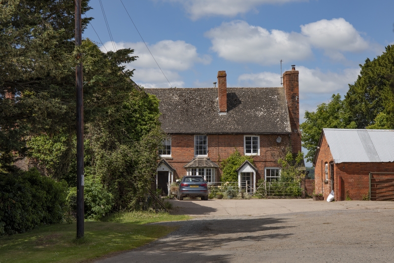
Farmhouse. Possibly C17, altered in C18 and c1900. Brick with tiled roofs and brick stacks. L-plan with main range aligned north/south and cross-wing projecting eastwards at south end. Cellar and two storeys. East elevation has 1:4 windows, two-light casements and sashes, brick plat band between floors, two gabled early C20 porches one to either side of central bay window. Main range, large external brick stack to right gable, gable front to left appears to have been remodelled c1900.
Interior noted as having heavy moulded ceiling beams in ground floor rooms.
(RCHM Vol I, p 238).
Listing NGR: SO4362834603
External links are from the relevant listing authority and, where applicable, Wikidata. Wikidata IDs may be related buildings as well as this specific building. If you want to add or update a link, you will need to do so by editing the Wikidata entry.


Other nearby listed buildings