Latitude: 52.3235 / 52°19'24"N
Longitude: -2.0192 / 2°1'9"W
OS Eastings: 398785
OS Northings: 269485
OS Grid: SO987694
Mapcode National: GBR 2G6.6BJ
Mapcode Global: VH9ZL.YVCQ
Plus Code: 9C4V8XFJ+98
Entry Name: Front Garden Wall of the Dusthouse
Listing Date: 16 July 1986
Grade: II
Source: Historic England
Source ID: 1100158
English Heritage Legacy ID: 156205
ID on this website: 101100158
Location: Tutnall, Bromsgrove, Worcestershire, B60
County: Worcestershire
District: Bromsgrove
Town: Bromsgrove
Civil Parish: Tutnall and Cobley
Traditional County: Worcestershire
Lieutenancy Area (Ceremonial County): Worcestershire
Church of England Parish: Tardebigge
Church of England Diocese: Worcester
Tagged with: Building
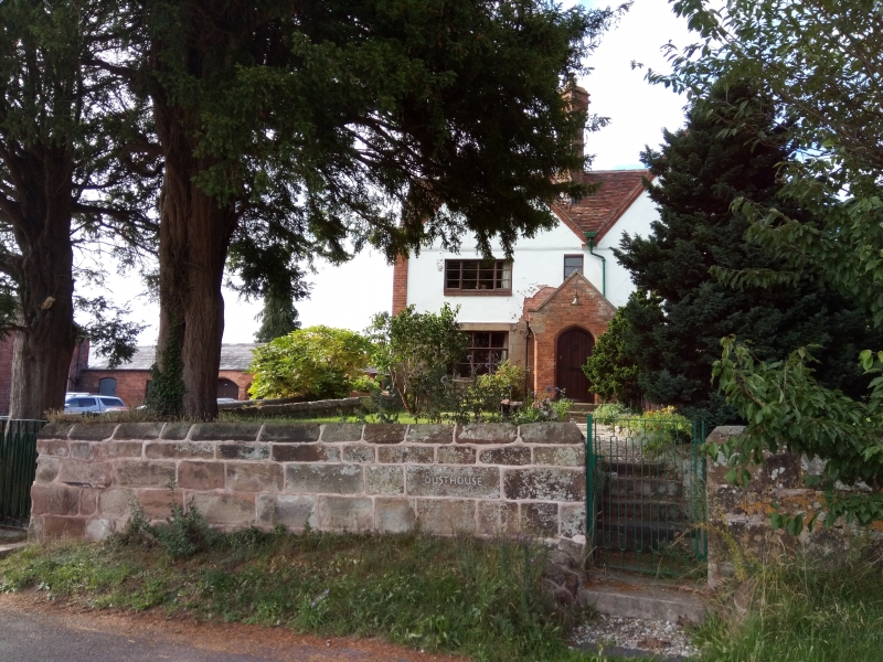
SO 96 NE TUTNALL & COBLEY CP DUSTHOUSE LANE (north side)
9/154 Front garden wall of
The Dusthouse
GV II
Garden walls. Late C17. Sandstone ashlar. Wall to south and east sides
of garden. Plain wall with triangular section coping.
Listing NGR: SO9878569485
External links are from the relevant listing authority and, where applicable, Wikidata. Wikidata IDs may be related buildings as well as this specific building. If you want to add or update a link, you will need to do so by editing the Wikidata entry.


Other nearby listed buildings