Latitude: 54.1809 / 54°10'51"N
Longitude: -2.9812 / 2°58'52"W
OS Eastings: 336061
OS Northings: 476570
OS Grid: SD360765
Mapcode National: GBR 7NM3.D0
Mapcode Global: WH83K.55NP
Plus Code: 9C6V52J9+9G
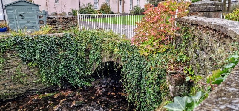
Entry Name: Bridge over River Eea to Cark Farm
Listing Date: 15 February 1989
Grade: II
Source: Historic England
Source ID: 1100242
English Heritage Legacy ID: 77057
ID on this website: 101100242
Location: Cark, Westmorland and Furness, Cumbria, LA11
County: Westmorland and Furness
District: South Lakeland
Civil Parish: Lower Holker
Built-Up Area: Flookburgh
Traditional County: Lancashire
Lieutenancy Area (Ceremonial County): Cumbria
Church of England Parish: Flookburgh St John the Baptist
Church of England Diocese: Carlisle
Tagged with: Bridge
LOWER HOLKER CARK-IN-CARTMEL SD 3676 9/143 Bridge over River Eea to Cark Farm G.V. II Bridge. Probably C18. Stone rubble with dressed stone. Segmental arch with dressed voussoirs. Parapets have triangular coping.
Listing NGR: SD3606176570
External links are from the relevant listing authority and, where applicable, Wikidata. Wikidata IDs may be related buildings as well as this specific building. If you want to add or update a link, you will need to do so by editing the Wikidata entry.


Other nearby listed buildings