Approximate Location Map
Large Map »
Latitude: 52.3357 / 52°20'8"N
Longitude: -2.0602 / 2°3'36"W
OS Eastings: 395994
OS Northings: 270848
OS Grid: SO959708
Mapcode National: GBR 2FY.FZG
Mapcode Global: VH9ZL.7KQ9
Plus Code: 9C4V8WPQ+7W
Entry Name: 89A, High Street
Listing Date: 5 April 1986
Grade: II
Source: Historic England
Source ID: 1100369
English Heritage Legacy ID: 155759
ID on this website: 101100369
Location: Bromsgrove, Worcestershire, B61
County: Worcestershire
District: Bromsgrove
Electoral Ward/Division: Sanders Park
Parish: Non Civil Parish
Built-Up Area: Bromsgrove
Traditional County: Worcestershire
Lieutenancy Area (Ceremonial County): Worcestershire
Church of England Parish: Bromsgrove
Church of England Diocese: Worcester
Tagged with: Building
HIGH STREET (west-side)
1.
5242
No. 89a
SO 97 SE SP/587
II GV
2.
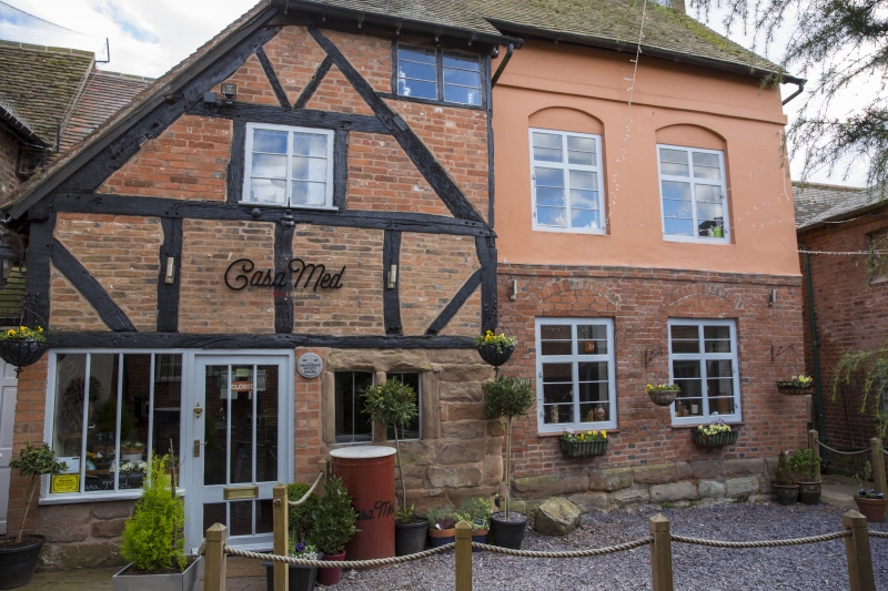
House. C17 & C18 , altered in C19. Part timber-framed and part red brick. Timber-framed
wing to east with brick unfilling underbuilt in brick and stone; wing to west of red
brick, rendered on first floor. Plain tiled roofs with stacks at each end of west wing.
1 1/2 storeys to left with 2 storeys and garret to right. Cross-gable to left with stone
underbuilding to right on ground floor with single two-light mullioned window and garage
door to left. Two-light garret window above, with later inserted window to right. Small
window above to right, above principal rafter where gable-end has been incorporated into
later wing to right. Right-hand wing set back slightly. Platbands over both ground and
first floors. Cross windows on first floor with segment-headed reveals and boarded-up
windows on ground floor with segmental relieving arches above. A low wing to left joins
No. 89A to No. 89, High Street (qv).
Listing NGR: SO9600770846
External links are from the relevant listing authority and, where applicable, Wikidata. Wikidata IDs may be related buildings as well as this specific building. If you want to add or update a link, you will need to do so by editing the Wikidata entry.


Other nearby listed buildings
