Latitude: 51.226 / 51°13'33"N
Longitude: 1.2257 / 1°13'32"E
OS Eastings: 625318
OS Northings: 152368
OS Grid: TR253523
Mapcode National: GBR W0C.4P7
Mapcode Global: VHLGX.6G90
Plus Code: 9F3366GG+C7
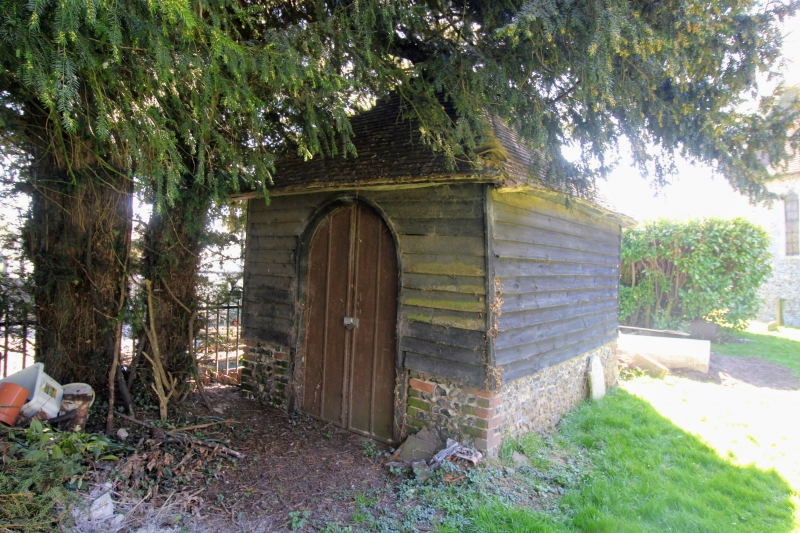
Entry Name: Charnel House or Mortuary Chapel About 20 Metres South of Church of St Mary
Listing Date: 3 December 1986
Grade: II
Source: Historic England
Source ID: 1101555
English Heritage Legacy ID: 178015
ID on this website: 101101555
Location: St Mary's Church, Nonington, Dover, Kent, CT15
County: Kent
District: Dover
Civil Parish: Nonington
Built-Up Area: Nonington
Traditional County: Kent
Lieutenancy Area (Ceremonial County): Kent
Tagged with: Building
NONINGTON PINNERS LANE TR 25 SE (north side) 3/154 Charnel house or mortuary chapel about 20 metres south of church of St.Mary GV II Charnel house or mortuary chapel. Mid C19. Timber framed and weather boarded on flint and red brick base with plain tiled roof. Single bay with hipped roof, with round headed doorway and boarded door with strap hinges on south elevation.
Listing NGR: TR2534252361
External links are from the relevant listing authority and, where applicable, Wikidata. Wikidata IDs may be related buildings as well as this specific building. If you want to add or update a link, you will need to do so by editing the Wikidata entry.


Other nearby listed buildings