Approximate Location Map
Large Map »
Latitude: 51.794 / 51°47'38"N
Longitude: 0.0399 / 0°2'23"E
OS Eastings: 540778
OS Northings: 212566
OS Grid: TL407125
Mapcode National: GBR LD6.JWY
Mapcode Global: VHHM5.M5ZJ
Plus Code: 9F32Q2VQ+JX
Entry Name: The Old Bungalow at Olives Farm 90 Metres South South West of House
Listing Date: 19 September 1984
Grade: II
Source: Historic England
Source ID: 1101952
English Heritage Legacy ID: 160003
ID on this website: 101101952
Location: East Hertfordshire, SG12
County: Hertfordshire
District: East Hertfordshire
Civil Parish: Hunsdon
Traditional County: Hertfordshire
Lieutenancy Area (Ceremonial County): Hertfordshire
Church of England Parish: Hunsdon
Church of England Diocese: St.Albans
Tagged with: Building
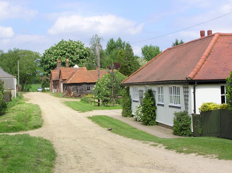
TL 41 SW HUNSDON STANSTEAD ROAD
(south side)
2/6 The Old Bungalow at
Olives Farm 90 metres
- SSW of house
GV II
House, early Cl9. Timberframed, part plastered and part
weatherboarded, L-shaped farm cottage facing W with steep red
tiled hipped roof. On right-hand plastered part, a symmetrical
arrangement of door with a window each side. Rear wing at S end.
3-light small-paned flush wooden casement windows. Lefthand part
weatherboarded under continuation of same roof. Plank door
against house and high 2-light opening for ventilation. An
interesting late timberframed single storey house. Part of a
picturesque group with the farm house.
Listing NGR: TL4077812566
External links are from the relevant listing authority and, where applicable, Wikidata. Wikidata IDs may be related buildings as well as this specific building. If you want to add or update a link, you will need to do so by editing the Wikidata entry.


Other nearby listed buildings
