Approximate Location Map
Large Map »
Latitude: 51.7444 / 51°44'39"N
Longitude: -0.2429 / 0°14'34"W
OS Eastings: 521405
OS Northings: 206538
OS Grid: TL214065
Mapcode National: GBR J9R.RD3
Mapcode Global: VHGPR.QFY3
Plus Code: 9C3XPQV4+QR
Entry Name: The Grove
Listing Date: 27 September 1984
Grade: II
Source: Historic England
Source ID: 1102983
English Heritage Legacy ID: 163561
ID on this website: 101102983
Location: Bullen's Green, St. Albans, Hertfordshire, AL4
County: Hertfordshire
District: St. Albans
Civil Parish: Colney Heath
Built-Up Area: Colney Heath
Traditional County: Hertfordshire
Lieutenancy Area (Ceremonial County): Hertfordshire
Church of England Parish: Colney Heath St Mark
Church of England Diocese: St.Albans
Tagged with: Building
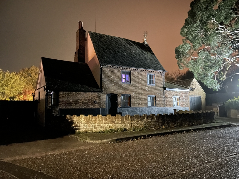
TL 20 NW COLNEY HEATH ROESTOCK LANE
(north west side)
BULLEN'S GREEN
11/26 The Grove
-
- II
House. C15-16; late C17 chimney stack on left gable end; late
C18 front. Timber frame with red brick facade. Plastered left
gable end. Very steeply pitched machine tile roof. 2 storeys. 2
C20 casements, those on ground floor segmental-headed. Plank
door on left end. Corbelled brick dentilled eaves. Interior has
crown post roof. Single storey wing on left of C18 origin; C20
garage on right.
Listing NGR: TL2140506538
External links are from the relevant listing authority and, where applicable, Wikidata. Wikidata IDs may be related buildings as well as this specific building. If you want to add or update a link, you will need to do so by editing the Wikidata entry.


Other nearby listed buildings
