Latitude: 51.7532 / 51°45'11"N
Longitude: -0.3558 / 0°21'20"W
OS Eastings: 513593
OS Northings: 207338
OS Grid: TL135073
Mapcode National: GBR H89.0WM
Mapcode Global: VHFS7.S689
Plus Code: 9C3XQJ3V+7M
Entry Name: St Michael's Church of England Primary School
Listing Date: 27 August 1971
Grade: II
Source: Historic England
Source ID: 1103088
English Heritage Legacy ID: 163414
ID on this website: 101103088
Location: St. Albans, Hertfordshire, AL3
County: Hertfordshire
District: St. Albans
Electoral Ward/Division: Verulam
Parish: Non Civil Parish
Built-Up Area: St Albans
Traditional County: Hertfordshire
Lieutenancy Area (Ceremonial County): Hertfordshire
Church of England Parish: St Albans St Michael
Church of England Diocese: St.Albans
Tagged with: Building
ST MICHAEL'S STREET 1. (South Side) 1582 St Michael's Church of England Primary School
TL 1307 SE 7/275
II GV
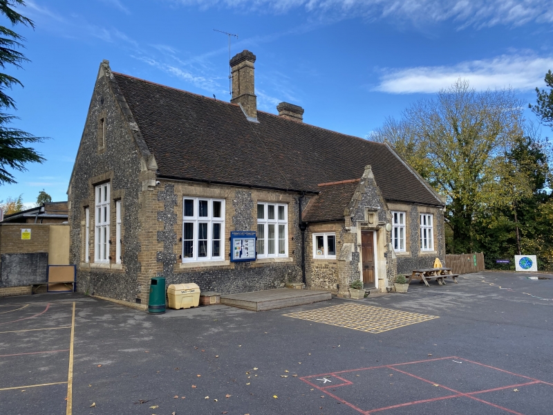
2. Mid C19. One storey and attic. 2 long, gabled wings with short cross link. High pitched roof with alternate bands of plain and fishscale tiles. Flint walls with yellow brick cornice, quoins, window dressings and plinth. Main east front, of 6 bays, has 5 windows and porch in 3rd bay from left. 3-light windows have wood mullions and transoms Gabled porch has door with square label raised in centre to hold coat of anus (uninscribed).
St Michael's Church of England School, St Michael's Church and Jessamine Cottage form a group.
Listing NGR: TL1359307338
External links are from the relevant listing authority and, where applicable, Wikidata. Wikidata IDs may be related buildings as well as this specific building. If you want to add or update a link, you will need to do so by editing the Wikidata entry.


Other nearby listed buildings