Latitude: 51.7438 / 51°44'37"N
Longitude: -0.3341 / 0°20'2"W
OS Eastings: 515111
OS Northings: 206328
OS Grid: TL151063
Mapcode National: GBR H8B.LC6
Mapcode Global: VHGPQ.5F7J
Plus Code: 9C3XPMV8+G9
Entry Name: Sopwell Nunnery Ruins
Listing Date: 27 August 1971
Grade: II
Source: Historic England
Source ID: 1103135
English Heritage Legacy ID: 163228
ID on this website: 101103135
Location: Sopwell, St. Albans, Hertfordshire, AL1
County: Hertfordshire
District: St. Albans
Electoral Ward/Division: Sopwell
Parish: Non Civil Parish
Built-Up Area: St Albans
Traditional County: Hertfordshire
Lieutenancy Area (Ceremonial County): Hertfordshire
Church of England Parish: St Albans St Stephen
Church of England Diocese: St.Albans
1. 1582 COTTONMILL LANE (East Side)
Sopwell Nunnery ruins TL 10 NE 24/120
II
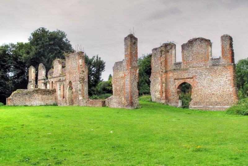
2. Unroofed ruins of a very large, 2-storey mansion, built in mid C16 by Sir Richard Lee from and among the remains of the original Sopwell Nunnery. On East face 3-light Perpendicular mullioned windows have been partly blocked or extended in this re-building. Walls of flint with brick headers and dressings, and moulded stone string. Various other foundations and parts of buildings, much overgrown. Large building to West in field has been modernised later, then demolished, but mediaeval foundations standing. AM.
Listing NGR: TL1511106328


Other nearby listed buildings