Approximate Location Map
Large Map »
Latitude: 50.7996 / 50°47'58"N
Longitude: -3.8968 / 3°53'48"W
OS Eastings: 266428
OS Northings: 101722
OS Grid: SS664017
Mapcode National: GBR KY.YYFW
Mapcode Global: FRA 26QZ.HP2
Plus Code: 9C2RQ4X3+V7
Entry Name: Churchyard Cross
Listing Date: 8 October 1987
Grade: II
Source: Historic England
Source ID: 1105339
English Heritage Legacy ID: 92976
ID on this website: 101105339
Location: St Peter's Church, North Tawton, West Devon, EX20
County: Devon
District: West Devon
Civil Parish: North Tawton
Built-Up Area: North Tawton
Traditional County: Devon
Lieutenancy Area (Ceremonial County): Devon
Church of England Parish: North Tawton St Peter
Church of England Diocese: Exeter
NORTH TAWTON ESSINGTON ROAD, North Tawton
SS 60 SE
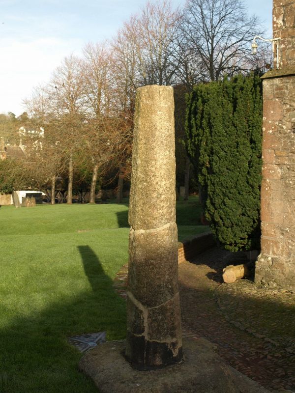
13/93 Churchyard Cross
GV II
Cross. Medieval. Tapering granite shaft with chamfered edges set in square socket
stone, head and arms are missing. Moved to present site from the town square in
1887.
Listing NGR: SS6642801722
External links are from the relevant listing authority and, where applicable, Wikidata. Wikidata IDs may be related buildings as well as this specific building. If you want to add or update a link, you will need to do so by editing the Wikidata entry.


Other nearby listed buildings
