Latitude: 50.5403 / 50°32'25"N
Longitude: -3.8939 / 3°53'38"W
OS Eastings: 265892
OS Northings: 72886
OS Grid: SX658728
Mapcode National: GBR Q8.V7JC
Mapcode Global: FRA 27QM.QT6
Plus Code: 9C2RG4R4+4C
Entry Name: Hexworthy or Huccaby Bridge
Listing Date: 28 October 1987
Grade: II
Source: Historic England
Source ID: 1105453
English Heritage Legacy ID: 92743
ID on this website: 101105453
Location: Hexworthy, West Devon, PL20
County: Devon
District: West Devon
Civil Parish: Dartmoor Forest
Traditional County: Devon
Lieutenancy Area (Ceremonial County): Devon
Church of England Parish: Holne St Mary the Virgin
Church of England Diocese: Exeter
Tagged with: Bridge
LYDFORD SX 67 SE 16/9 Hexworthy or Huccaby Bridge 21.3.67 - II
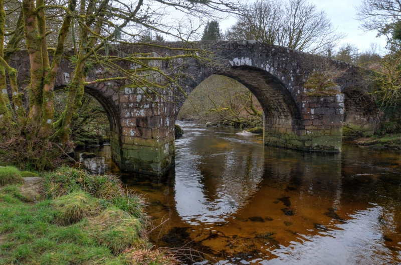
Road bridge over West Dart river. Circa late C18. Granite rubble with dressed granite voussoirs and some granite ashlar to jambs and cutwaters. 3-span segmental arches with projecting keystones, the central arch considerably wider. Divided by triangular cutwaters built in diminishing courses. Cranked parapet with roughly dressed coping stones.
Listing NGR: SX6589072884
External links are from the relevant listing authority and, where applicable, Wikidata. Wikidata IDs may be related buildings as well as this specific building. If you want to add or update a link, you will need to do so by editing the Wikidata entry.


Other nearby listed buildings