Latitude: 51.1444 / 51°8'39"N
Longitude: -3.9831 / 3°58'59"W
OS Eastings: 261379
OS Northings: 140217
OS Grid: SS613402
Mapcode National: GBR KV.80T4
Mapcode Global: VH4ML.XH5K
Plus Code: 9C3R42V8+QQ
Entry Name: Cairn Approximately 600 Metres South East of Arlington Court
Listing Date: 9 April 1987
Grade: II
Source: Historic England
Source ID: 1106819
English Heritage Legacy ID: 96982
ID on this website: 101106819
Location: Arlington, North Devon, EX31
County: Devon
District: North Devon
Civil Parish: Arlington
Traditional County: Devon
Lieutenancy Area (Ceremonial County): Devon
Church of England Parish: East Down St John the Baptist
Church of England Diocese: Exeter
Tagged with: Cairn
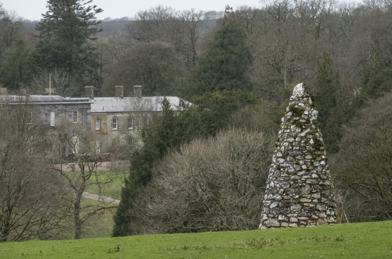
ARLINGTON ARLINGTON SS 64 SW 5/7 Cairn approximately 600 metres south-east of Arlington Court GV II Cairn. 1887. White random quartz marble stone. Tall circular cairn tapering to a point, with plaque on south side recording that 'On this spot a bonfire was lit to commemorate the Jubilee of Queen Victoria. June 21 '1887'.
Listing NGR: SS6137940217
External links are from the relevant listing authority and, where applicable, Wikidata. Wikidata IDs may be related buildings as well as this specific building. If you want to add or update a link, you will need to do so by editing the Wikidata entry.


Other nearby listed buildings