Latitude: 50.3285 / 50°19'42"N
Longitude: -4.0674 / 4°4'2"W
OS Eastings: 252947
OS Northings: 49661
OS Grid: SX529496
Mapcode National: GBR NZ.XR2T
Mapcode Global: FRA 28C5.H6M
Plus Code: 9C2Q8WHM+93
Entry Name: 27, Knighton Road
Listing Date: 19 July 1984
Grade: II
Source: Historic England
Source ID: 1108584
English Heritage Legacy ID: 100457
ID on this website: 101108584
Location: Knighton, South Hams, Devon, PL9
County: Devon
District: South Hams
Civil Parish: Wembury
Built-Up Area: Knighton
Traditional County: Devon
Lieutenancy Area (Ceremonial County): Devon
Tagged with: Building
SX 54 NW WEMBURY KNIGHTON ROAD, KNIGHTON 8/178 No. 27
II
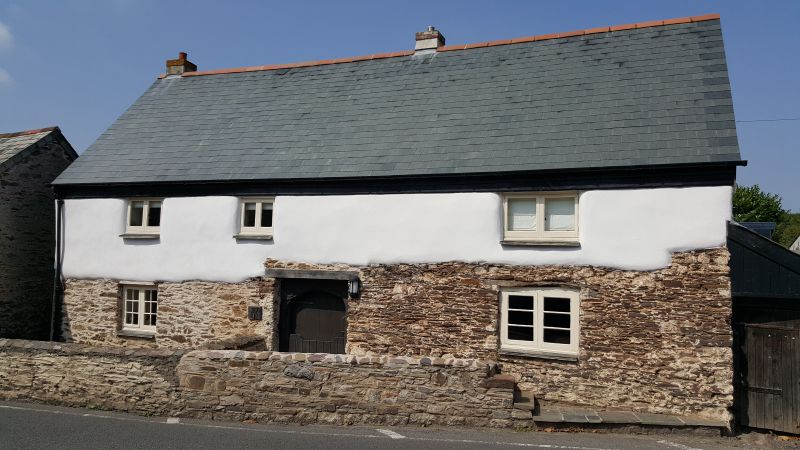
Cottage. Circa C16/17. Colourwashed rubble. Steeply pitched asbestos slate roof with gabled ends. Two storeys. Three window range. Small C19 and C20 two-light casements. Central doorway to cross-passage with chamfered wooden four-centred arch frame and old boarded door. Large C20 dormers at rear and outshut. Central chimney stack removed. Interior: wooden newel stairs at either end. One fireplace with timber bressumer with one stone corbel.
Listing NGR: SX5294749661
External links are from the relevant listing authority and, where applicable, Wikidata. Wikidata IDs may be related buildings as well as this specific building. If you want to add or update a link, you will need to do so by editing the Wikidata entry.


Other nearby listed buildings