Latitude: 53.017 / 53°1'1"N
Longitude: -1.7332 / 1°43'59"W
OS Eastings: 417992
OS Northings: 346667
OS Grid: SK179466
Mapcode National: GBR 48Q.SQC
Mapcode Global: WHCF5.BFWF
Plus Code: 9C5W2788+RP
Entry Name: WH Smith
Listing Date: 14 February 1974
Grade: II
Source: Historic England
Source ID: 1109496
English Heritage Legacy ID: 79907
ID on this website: 101109496
Location: Ashbourne, Derbyshire Dales, Derbyshire, DE6
County: Derbyshire
District: Derbyshire Dales
Civil Parish: Ashbourne
Built-Up Area: Ashbourne
Traditional County: Derbyshire
Lieutenancy Area (Ceremonial County): Derbyshire
Church of England Parish: Ashbourne St Oswald
Church of England Diocese: Derby
Tagged with: Building
ST JOHNS STREET
1.
783
(South-East Side)
No 6
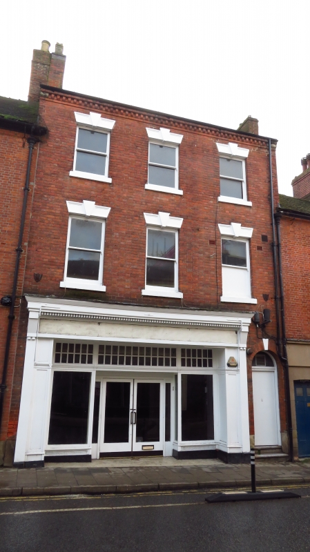
(W H Smith)
SK 14 NE 1/69
II GV
Late C18/earlier C19. Red brick; tiled roof; 3 storey but slightly higher than
adjacent bank building. 3 unbarred sashes, painted panelled lintels with keyblocks
Brick eaves with projecting headers. Tiles. Modern shop front.
No 2 and Nos 6 to 44 (even) form a group.
Listing NGR: SK1799246667
External links are from the relevant listing authority and, where applicable, Wikidata. Wikidata IDs may be related buildings as well as this specific building. If you want to add or update a link, you will need to do so by editing the Wikidata entry.


Other nearby listed buildings