Approximate Location Map
Large Map »
Latitude: 53.0164 / 53°0'59"N
Longitude: -1.7347 / 1°44'4"W
OS Eastings: 417893
OS Northings: 346599
OS Grid: SK178465
Mapcode National: GBR 48Q.S9P
Mapcode Global: WHCF5.BF5X
Plus Code: 9C5W2788+H4
Entry Name: 28, Church Street
Listing Date: 15 June 1951
Grade: II
Source: Historic England
Source ID: 1109547
English Heritage Legacy ID: 79828
ID on this website: 101109547
Location: Bellevue, Derbyshire Dales, Derbyshire, DE6
County: Derbyshire
District: Derbyshire Dales
Civil Parish: Ashbourne
Built-Up Area: Ashbourne
Traditional County: Derbyshire
Lieutenancy Area (Ceremonial County): Derbyshire
Church of England Parish: Ashbourne St Oswald
Church of England Diocese: Derby
Tagged with: Building
CHURCH STREET
1.
783
(South-East Side)
No 28
SK 14 NE 1/16 15.6.5l.
II GV
2.
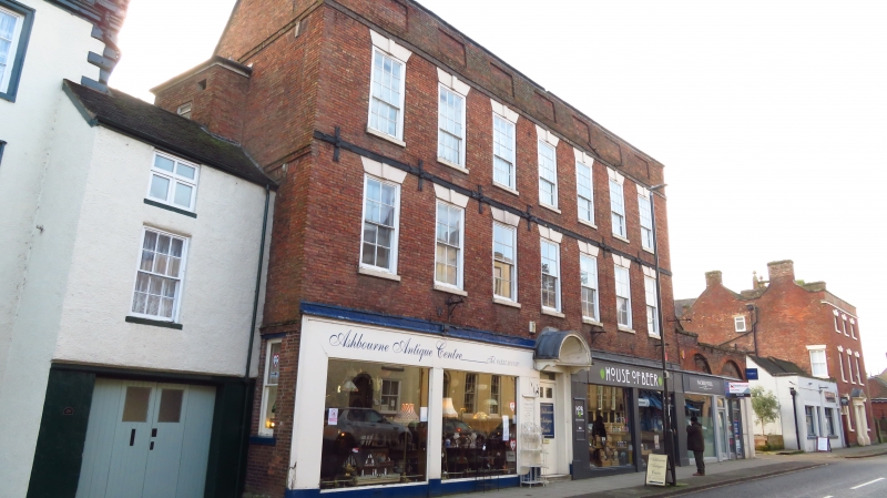
Early C18. Red brick with panelled parapet. Roof not visible. 3 storeys, 7
windows with plain keyblocks and lintels, unbarred on 2nd storey. Modern shop
front through retaining central original wood shell hood on plain modillion brackets.
Nos 12 to 28 (even) form a group.
Listing NGR: SK1789346599
External links are from the relevant listing authority and, where applicable, Wikidata. Wikidata IDs may be related buildings as well as this specific building. If you want to add or update a link, you will need to do so by editing the Wikidata entry.


Other nearby listed buildings
