Approximate Location Map
Large Map »
Latitude: 53.0166 / 53°0'59"N
Longitude: -1.735 / 1°44'5"W
OS Eastings: 417876
OS Northings: 346618
OS Grid: SK178466
Mapcode National: GBR 48Q.S71
Mapcode Global: WHCF5.BF2S
Plus Code: 9C5W2788+J2
Entry Name: 25, Church Street
Listing Date: 6 May 1970
Grade: II
Source: Historic England
Source ID: 1335135
English Heritage Legacy ID: 79810
ID on this website: 101335135
Location: Bellevue, Derbyshire Dales, Derbyshire, DE6
County: Derbyshire
District: Derbyshire Dales
Civil Parish: Ashbourne
Built-Up Area: Ashbourne
Traditional County: Derbyshire
Lieutenancy Area (Ceremonial County): Derbyshire
Church of England Parish: Ashbourne St Oswald
Church of England Diocese: Derby
Tagged with: Building
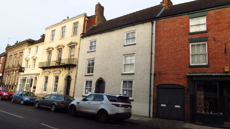
CHURCH STREET
1.
783
(North-West Side)
No 25
SK 14 NE 1/54 6.5.70.
II GV
2.
C18. Roughcast with stucco plinth and tiled roof. 3 storeys, 2 windows. Central
doorway, semi-circular moulded architrave with central keyblock and impost blocks.
Windows with moulded frames. Steps.
Nos 17 to 4l (odd) form a group.
Listing NGR: SK1787646618
External links are from the relevant listing authority and, where applicable, Wikidata. Wikidata IDs may be related buildings as well as this specific building. If you want to add or update a link, you will need to do so by editing the Wikidata entry.


Other nearby listed buildings
