Latitude: 53.3225 / 53°19'20"N
Longitude: -1.3988 / 1°23'55"W
OS Eastings: 440143
OS Northings: 380784
OS Grid: SK401807
Mapcode National: GBR LZN0.YP
Mapcode Global: WHDDX.HR49
Plus Code: 9C5W8JC2+XF
Entry Name: Farm Outbuilding 20 Metres North West of Commonside Farmhouse
Listing Date: 6 April 1989
Grade: II
Source: Historic England
Source ID: 1109658
English Heritage Legacy ID: 79593
ID on this website: 101109658
Location: Ridgeway, North East Derbyshire, S12
County: Derbyshire
District: North East Derbyshire
Civil Parish: Eckington
Built-Up Area: Sheffield
Traditional County: Derbyshire
Lieutenancy Area (Ceremonial County): Derbyshire
Church of England Parish: Eckington and Ridgeway
Church of England Diocese: Derby
Tagged with: Appendage
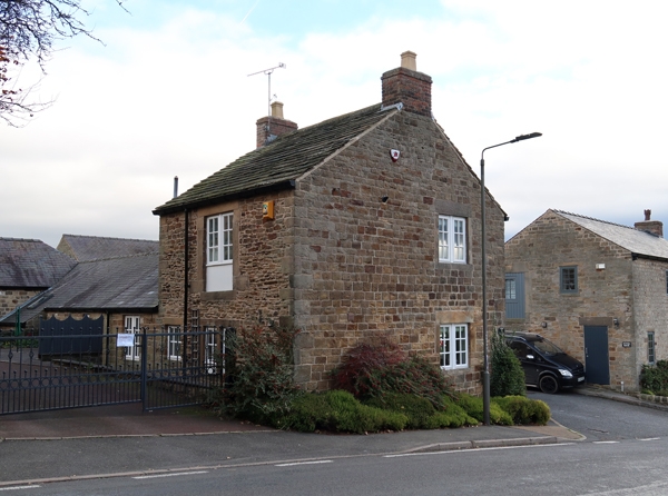
PARISH OF ECKINGTON RIDGEWAY MOOR SK 48 SW 2/112 Farm Outbuilding 20 metres north-west 6.4.89 of Commonside Farmhouse II Farm outbuilding, formerly edge tool workshop. Late C18, with C19 and C20 alterations. Coursed squared coal measures sandstone with quoins, plain gables with brick stacks, and a stone slated roof. North elevation. Two storeys, single bay, with 2-light flush mullioned window to the ground floor with glazing bar casements. To the east a C20 2-light window in a plain opening. To the first floor a tall loading doorway with massive ashlar surround and lintel, and plain planked double doors. South elevation with external stone staircase to first floor doorway. 2-light flush mullioned window, and a single doorway with massive surround and plain plank door. History. The parish of Eckington was an important centre for agricultural edge tool manufacture from the C16 to the C19. Commonside Farm, of which this building forms a part, is referred to as Commonside Manufactury (Sickle) on the 1875 edition of the Ordnance Survey map. No other buildings forming part of Commonside Farm are included in this or any other list.
Listing NGR: SK4014380784
External links are from the relevant listing authority and, where applicable, Wikidata. Wikidata IDs may be related buildings as well as this specific building. If you want to add or update a link, you will need to do so by editing the Wikidata entry.


Other nearby listed buildings