Latitude: 53.2439 / 53°14'37"N
Longitude: -1.7052 / 1°42'18"W
OS Eastings: 419770
OS Northings: 371912
OS Grid: SK197719
Mapcode National: GBR JZJX.MW
Mapcode Global: WHCD0.SQ6K
Plus Code: 9C5W67VV+GW
Entry Name: The Farm
Listing Date: 22 March 1985
Grade: II
Source: Historic England
Source ID: 1109910
English Heritage Legacy ID: 80942
ID on this website: 101109910
Location: Great Longstone, Derbyshire Dales, Derbyshire, DE45
County: Derbyshire
District: Derbyshire Dales
Civil Parish: Great Longstone
Built-Up Area: Great Longstone
Traditional County: Derbyshire
Lieutenancy Area (Ceremonial County): Derbyshire
Church of England Parish: Longstone St Giles
Church of England Diocese: Derby
Tagged with: Building
SK 17 SE PARISH OF GREAT LONGSTONE MAIN STREET 3/29 (South Side) The Farm II
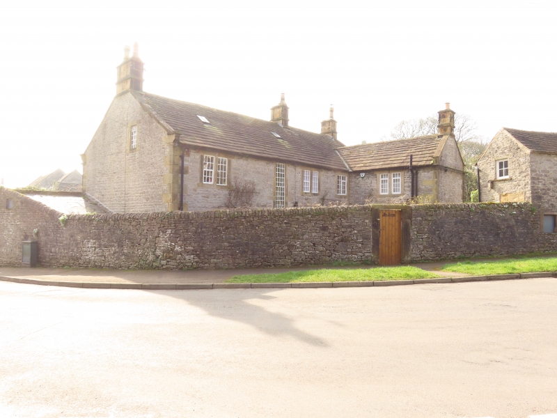
Farmhouse. Late C18 and early C19. Coursed rubble limestone with gritstone dressings. Welsh slate roof to south, stone slate to north. Three stone gable end stacks and one ridge stack. Stone coped gables with moulded kneelers. Flush quoins. Two storeys, L-plan. South elevation of three bays. Right hand two bays symmetrical and earlier, with central doorway with flush jambs and lintel and hoodmould. C20 glazed door. Flanked on each side by glazing bar sashes in stone surrounds. Two similar windows above. Left bay is an addition, with a large 2-light window with glazing bar sashes on the ground floor and a single glazing bar sash above. Both with stone surrounds. North elevation has a tall staircase window and smaller 2-light square section flush mullion windows.
Listing NGR: SK1977071912
External links are from the relevant listing authority and, where applicable, Wikidata. Wikidata IDs may be related buildings as well as this specific building. If you want to add or update a link, you will need to do so by editing the Wikidata entry.


Other nearby listed buildings