Latitude: 53.2435 / 53°14'36"N
Longitude: -1.7041 / 1°42'14"W
OS Eastings: 419844
OS Northings: 371875
OS Grid: SK198718
Mapcode National: GBR JZJX.VZ
Mapcode Global: WHCD0.SQQT
Plus Code: 9C5W67VW+C9
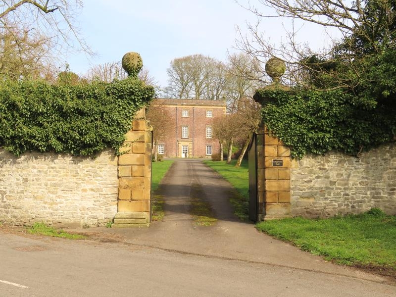
Entry Name: Gate Piers, Attached Boundary Walls, Pump and Trough at the Hall
Listing Date: 12 July 1967
Grade: II
Source: Historic England
Source ID: 1311531
English Heritage Legacy ID: 80926
ID on this website: 101311531
Location: Great Longstone, Derbyshire Dales, Derbyshire, DE45
County: Derbyshire
District: Derbyshire Dales
Civil Parish: Great Longstone
Built-Up Area: Great Longstone
Traditional County: Derbyshire
Lieutenancy Area (Ceremonial County): Derbyshire
Church of England Parish: Longstone St Giles
Church of England Diocese: Derby
Tagged with: Gatepost
SK 17 SE PARISH OF GREAT LONGSTONE MAIN STREET 3/13 (North Side) 12.7.67 Gate piers, attached boundary walls, pump and trough at the Hall GV II
Gate piers, boundary walls, pump and trough. Mid C18 and C19. Rubble limestone and gritstone ashlar. Gate piers at south entrance, square in plan, rusticated with moulded caps and ball finials. Walls on each side, along the road, approximately ten feet tall with chamfered copings. The wall to the east continues as an enclosure to a walled garden and has an C18 gateway, with rusticated quoins to the south and moulded architrave with keystone to the north. Another wall runs north towards the Hall, dividing the drive from the enclosed garden. The wall follows the road to the west to the entrance to the stableyard, where there is another pair of gate piers. Next to them, a C19 fluted metal pump and a stone trough. Included for group value only.
Listing NGR: SK1984471875
External links are from the relevant listing authority and, where applicable, Wikidata. Wikidata IDs may be related buildings as well as this specific building. If you want to add or update a link, you will need to do so by editing the Wikidata entry.


Other nearby listed buildings