Latitude: 50.7325 / 50°43'57"N
Longitude: -1.7755 / 1°46'31"W
OS Eastings: 415939
OS Northings: 92570
OS Grid: SZ159925
Mapcode National: GBR 55B.V8Y
Mapcode Global: FRA 7754.N3X
Plus Code: 9C2WP6MF+2Q
Entry Name: Christchurch Priory Churchyard Wall Between Priory Church and Vicarage
Listing Date: 12 February 1976
Grade: II
Source: Historic England
Source ID: 1110071
English Heritage Legacy ID: 101616
ID on this website: 101110071
Location: Wick, Bournemouth, Christchurch and Poole, Dorset, BH23
County: Bournemouth, Christchurch and Poole
Parish: Christchurch
Built-Up Area: Christchurch
Traditional County: Hampshire
Lieutenancy Area (Ceremonial County): Dorset
Church of England Parish: Christchurch Holy Trinity
Church of England Diocese: Winchester
Tagged with: Building
QUAY ROAD 1. (North East Side) 5187 Christchurch Priory Churchyard wall between Priory Church and Vicarage SZ 1592 1A/144
II GV
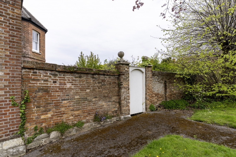
2. C18/early C19. Red brick circa 7 ft higher wall between Church Street and Quay Road. Entrance to Vicarage from Churchyard has brick gate piers with stone caps and ball finials.
Nos 1 and 2 form a group with the Red House Museum, its Art Gallery and Picture Store, the Museum Garden Wall and the Churchyard Walls and Vicarage. This group is also associated with that on Church Lane.
Listing NGR: SZ1593992570
External links are from the relevant listing authority and, where applicable, Wikidata. Wikidata IDs may be related buildings as well as this specific building. If you want to add or update a link, you will need to do so by editing the Wikidata entry.


Other nearby listed buildings