Latitude: 50.9248 / 50°55'29"N
Longitude: -2.3058 / 2°18'20"W
OS Eastings: 378600
OS Northings: 113968
OS Grid: ST786139
Mapcode National: GBR 0WZ.ZTG
Mapcode Global: FRA 661N.RHH
Plus Code: 9C2VWMFV+WM
Entry Name: 71, Bridge Street
Listing Date: 20 October 1983
Grade: II
Source: Historic England
Source ID: 1110568
English Heritage Legacy ID: 102392
ID on this website: 101110568
Location: Sturminster Newton, Dorset, DT10
County: Dorset
Civil Parish: Sturminster Newton
Built-Up Area: Sturminster Newton
Traditional County: Dorset
Lieutenancy Area (Ceremonial County): Dorset
Church of England Parish: Sturminster Newton St Mary
Church of England Diocese: Salisbury
Tagged with: Building
ST 7813 STURMINSTER NEWTON BRIDGE STREET (EAST SIDE)
9/110 No 71
G.V. II
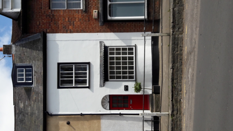
Cottage, C18. Stucco with slate roof and no visible stack. 2 storeys and attic. Ground floor has a bow window with glazing bars and a wooden cornice. The first floor and dormer each have a C19 sash with glazing bars. The door is to the left and is recessed under a round head.
Listing NGR: ST7860413967
External links are from the relevant listing authority and, where applicable, Wikidata. Wikidata IDs may be related buildings as well as this specific building. If you want to add or update a link, you will need to do so by editing the Wikidata entry.


Other nearby listed buildings