Latitude: 50.7149 / 50°42'53"N
Longitude: -2.4422 / 2°26'32"W
OS Eastings: 368874
OS Northings: 90677
OS Grid: SY688906
Mapcode National: GBR PY.RDK3
Mapcode Global: FRA 57S6.0CF
Plus Code: 9C2VPH75+X4
Entry Name: Top O Town House
Listing Date: 8 May 1975
Grade: II
Source: Historic England
Source ID: 1110621
English Heritage Legacy ID: 104212
ID on this website: 101110621
Location: Dorchester, Dorset, DT1
County: Dorset
Civil Parish: Dorchester
Built-Up Area: Dorchester
Traditional County: Dorset
Lieutenancy Area (Ceremonial County): Dorset
Church of England Parish: Dorchester and West Stafford
Church of England Diocese: Salisbury
Tagged with: House
BRIDPORT ROAD
1.
5191
(North Side)
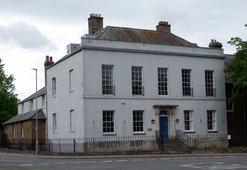
Top o'Town House
SY 6890 7/85
II
2.
Late C18. Stucco. 2 storeys. 5 ranges of windows. Moulded cornice. Parapet.
Slate roof. Doorway has elliptical head and flanking stone columns. Doric
entablature, cornice member being carried across as hood. Sash windows, those
to 1st floor having individual iron balconies.
Listing NGR: SY6887490677
External links are from the relevant listing authority and, where applicable, Wikidata. Wikidata IDs may be related buildings as well as this specific building. If you want to add or update a link, you will need to do so by editing the Wikidata entry.


Other nearby listed buildings