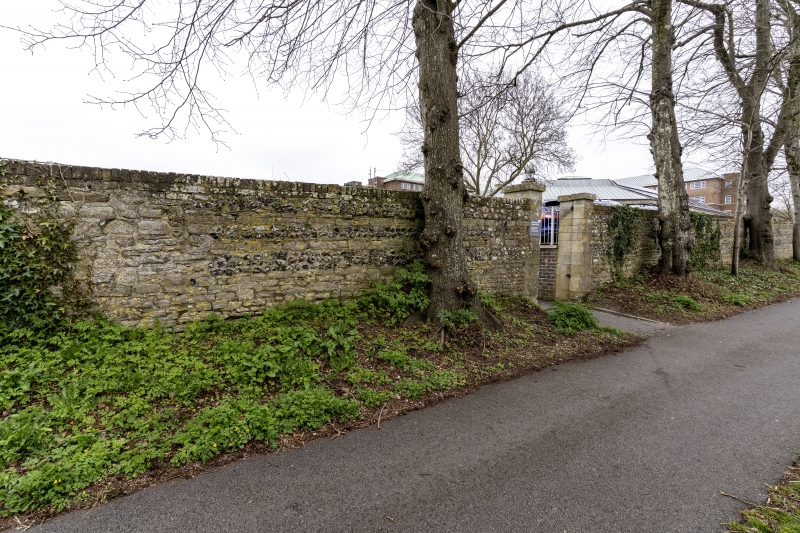
Latitude: 50.7178 / 50°43'4"N
Longitude: -2.4414 / 2°26'29"W
OS Eastings: 368934
OS Northings: 91004
OS Grid: SY689910
Mapcode National: GBR PY.R6SS
Mapcode Global: FRA 57S5.SSX
Plus Code: 9C2VPH95+4C
Entry Name: Wall on West and North Sides of Colliton Park
Listing Date: 8 May 1975
Grade: II
Source: Historic England
Source ID: 1110625
English Heritage Legacy ID: 104221
ID on this website: 101110625
Location: Colliton Park, Dorchester, Dorset, DT1
County: Dorset
Civil Parish: Dorchester
Built-Up Area: Dorchester
Traditional County: Dorset
Lieutenancy Area (Ceremonial County): Dorset
Church of England Parish: Dorchester and West Stafford
Church of England Diocese: Salisbury
Tagged with: Wall
COLLITON PARK 1. 5191 Wall on west and north sides of Colliton Park SY 6890 1/146 SY 6890 7/146 II 2. Early C18. Alternate bands of Ridgeway or Portland rubble and flints. Red brick coping. Ramped to circular red brick piers with gadrooned ashlar capitals.
Listing NGR: SY6893491004
External links are from the relevant listing authority and, where applicable, Wikidata. Wikidata IDs may be related buildings as well as this specific building. If you want to add or update a link, you will need to do so by editing the Wikidata entry.


Other nearby listed buildings