Latitude: 50.9481 / 50°56'53"N
Longitude: -2.5164 / 2°30'58"W
OS Eastings: 363820
OS Northings: 116643
OS Grid: ST638166
Mapcode National: GBR MV.ND9T
Mapcode Global: FRA 56ML.TPY
Plus Code: 9C2VWFXM+6C
Entry Name: Cutlers
Listing Date: 4 October 1973
Grade: II
Source: Historic England
Source ID: 1110794
English Heritage Legacy ID: 103839
ID on this website: 101110794
Location: Sherborne, Dorset, DT9
County: Dorset
Civil Parish: Sherborne
Built-Up Area: Sherborne
Traditional County: Dorset
Lieutenancy Area (Ceremonial County): Dorset
Church of England Parish: Sherborne with Castleton Abbey Church of St Mary
Church of England Diocese: Salisbury
Tagged with: Building
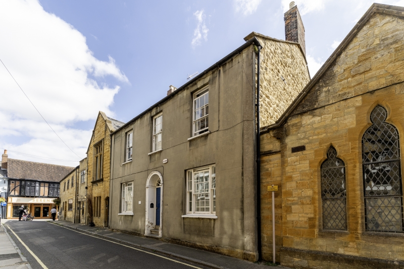
ABBEY ROAD 1. 1625 (South East Side) Cutlers ST 6316 1/16 II 2. Formerly shown as St Dunstan's. Early C19. 2-storey, 3 window rendered front. Sash windows. 3-light sash windows on ground floor. Round-headed doorway with moulded archivolt and reeded imposts. Radiating fanlight. Contemporary detail to rear elevation. Cutlers is a boarding house for Sherborne School.
Listing NGR: ST6382016643
External links are from the relevant listing authority and, where applicable, Wikidata. Wikidata IDs may be related buildings as well as this specific building. If you want to add or update a link, you will need to do so by editing the Wikidata entry.


Other nearby listed buildings