Latitude: 50.9478 / 50°56'52"N
Longitude: -2.5165 / 2°30'59"W
OS Eastings: 363809
OS Northings: 116617
OS Grid: ST638166
Mapcode National: GBR MV.NL7Q
Mapcode Global: FRA 56ML.TNR
Plus Code: 9C2VWFXM+49
Entry Name: The Methodist Church
Listing Date: 4 October 1973
Grade: II
Source: Historic England
Source ID: 1152188
English Heritage Legacy ID: 103918
ID on this website: 101152188
Location: Sherborne, Dorset, DT9
County: Dorset
Civil Parish: Sherborne
Built-Up Area: Sherborne
Traditional County: Dorset
Lieutenancy Area (Ceremonial County): Dorset
Church of England Parish: Sherborne with Castleton Abbey Church of St Mary
Church of England Diocese: Salisbury
Tagged with: Protestant church building
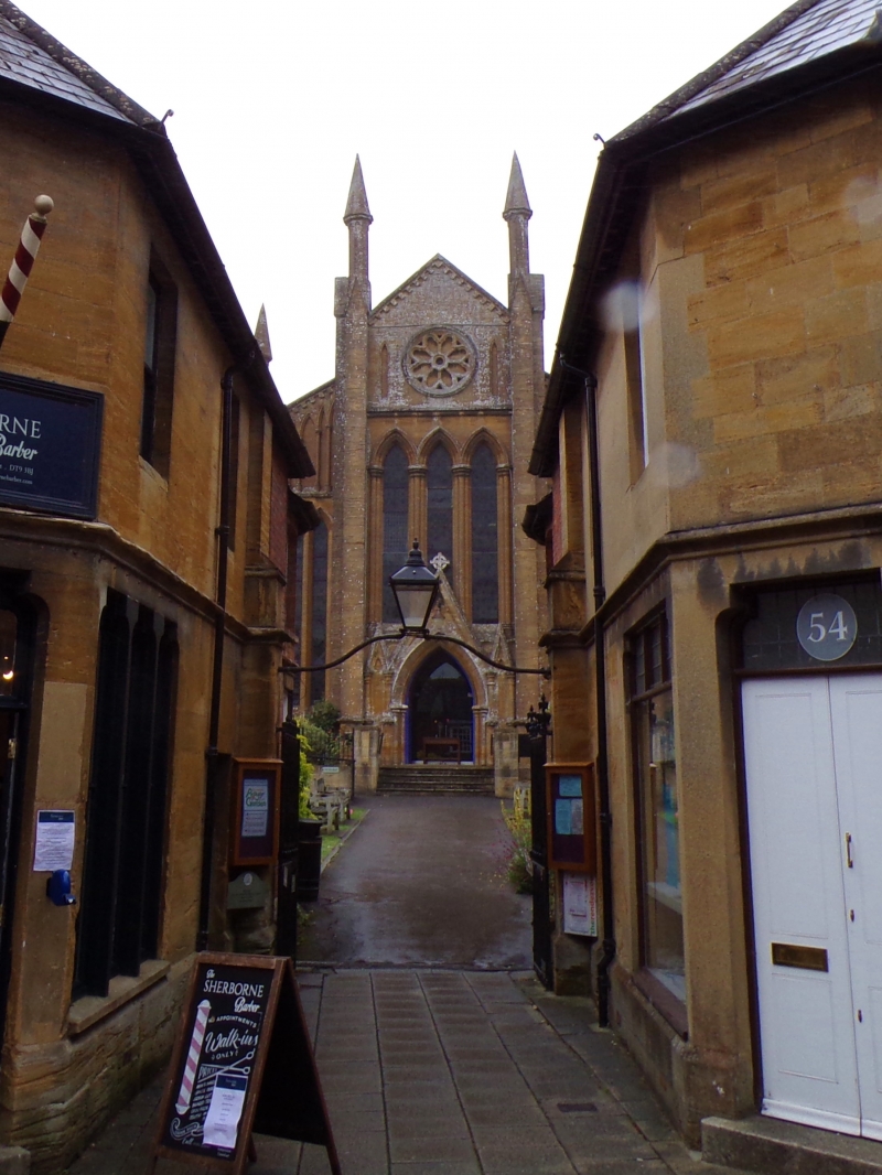
CHEAP STREET
1.
1625
(South West Side)
The Methodist Church
ST 6316 1/319
II GV
2.
184l-2. Galleries and western end of Church added in 1862. Further extension
added in 1884. Hwn stone East front has gable to middle section with giant
buttresses to each side, window of 3 lancet lights, above it, a blind rose
window flanked by blind lancet panels. Porch with wide pointed arch and
gable. In recession to either side, lower lean-to additions have tall
windows with pointed heads, and blind arcading. Return walls (to galleries)
of rubble, 5 window bays. West extension of ashlar, semi-octagonal apse
with tall 2-light cinquefoil window with round quatrefoil with dripmould
over to each facet, buttress with offsets at-each angle. An external
stair against the external stair of the main body of the church descends
to the undercroft and also rises to an entrance in the north-easternmost
facet of the apse.
(See G H D Pitman "Exploring Sherborne", p 31).
Nos 54 and 56, Gate, lamp and overthrow between Nos 54 and 56, The Methodist
Church and Nos 58 to 82 (even) form a group.
Listing NGR: ST6380916617
External links are from the relevant listing authority and, where applicable, Wikidata. Wikidata IDs may be related buildings as well as this specific building. If you want to add or update a link, you will need to do so by editing the Wikidata entry.


Other nearby listed buildings