Latitude: 50.9051 / 50°54'18"N
Longitude: -1.2744 / 1°16'27"W
OS Eastings: 451114
OS Northings: 111989
OS Grid: SU511119
Mapcode National: GBR 881.2MM
Mapcode Global: FRA 866Q.5BQ
Plus Code: 9C2WWP4G+26
Entry Name: Marks Farm; Granary 30 Yards North of Marks Farm Cottages
Listing Date: 14 February 1983
Grade: II
Source: Historic England
Source ID: 1112061
English Heritage Legacy ID: 354850
ID on this website: 101112061
Location: Eastleigh, Hampshire, SO30
County: Hampshire
District: Eastleigh
Civil Parish: Botley
Traditional County: Hampshire
Lieutenancy Area (Ceremonial County): Hampshire
Church of England Parish: Botley All Saints
Church of England Diocese: Portsmouth
Tagged with: Building
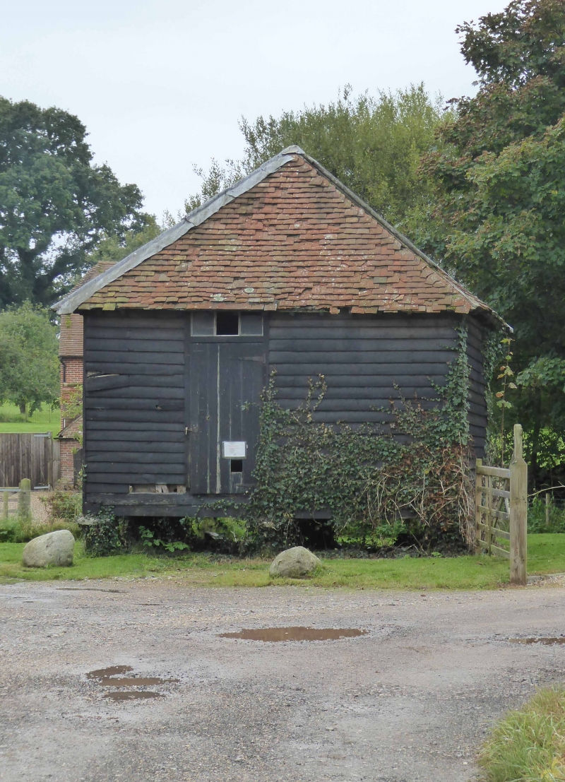
1.
5230 BOTLEY CHURCH LANE
Marks Farm;
Granary 30 yds north
of Marks Farm Cottages
SU 51 SW 7/8
II GV
2.
Probably early C19. Traditional granary, timber-framed and weatherboarded, with an
almost pyramid tile roof, all resting on 9 staddlestones.
Listing NGR: SU5085513531
External links are from the relevant listing authority and, where applicable, Wikidata. Wikidata IDs may be related buildings as well as this specific building. If you want to add or update a link, you will need to do so by editing the Wikidata entry.


Other nearby listed buildings