Latitude: 50.3659 / 50°21'57"N
Longitude: -4.1438 / 4°8'37"W
OS Eastings: 247624
OS Northings: 53979
OS Grid: SX476539
Mapcode National: GBR RB2.8G
Mapcode Global: FRA 2862.HFK
Plus Code: 9C2Q9V84+9F
Entry Name: Plymouth Conservative Club and Attached Forecourt Railings
Listing Date: 9 November 1998
Grade: II
Source: Historic England
Source ID: 1113339
English Heritage Legacy ID: 473561
ID on this website: 101113339
Location: West Hoe, Plymouth, Devon, PL1
County: City of Plymouth
Electoral Ward/Division: St Peter and the Waterfront
Parish: Non Civil Parish
Built-Up Area: Plymouth
Traditional County: Devon
Lieutenancy Area (Ceremonial County): Devon
Tagged with: Building
PLYMOUTH
SX4753 LOCKYER STREET, Hoe 740-1/66/279 (West side) Nos.1 AND 2 Plymouth Conservative Club and attached forecourt railings
GV II
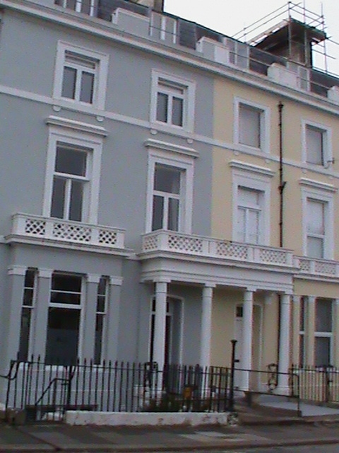
Pair of houses in planned terrace, now a club. Mid C19. Stucco; tiled mansard roof over moulded parapet cornice with slatehanging to front of roof flanking attic windows; stuccoed end stacks with moulded cornices. Double-depth plan. EXTERIOR: 3 storeys plus attic over basement; symmetrical 4-window front with late C19 or C20 2-pane horned sashes. Stucco detail includes: tetrastyle Tuscan porch with moulded entablature, the moulded cornice surmounted by a roundelled balustrade repeated over flanking slightly-projecting tripartite windows linked by a cornice string; 1st-floor sill string, eared architraves with moulded cornice hoods; 2nd-floor sill string with round brackets to shorter windows with eared architraves. Central pair of doorways, the right-hand doorway partly blocked and fitted with small sash. INTERIOR: not inspected but likely to be of interest. SUBSIDIARY FEATURES: low freestone forecourt plinth surmounted by original wrought-iron railings with cast-iron finials in bays between arched open "piers" with anthemion decoration and turned cast-iron columns/lamp standards flanking entrance. Included as part of an important planned group of terraces and villas by Foulston and his pupil Wightwick on the Hoe, a scheme which placed Plymouth in the forefront of town planning in the early/mid C19.
Listing NGR: SX4766754136
External links are from the relevant listing authority and, where applicable, Wikidata. Wikidata IDs may be related buildings as well as this specific building. If you want to add or update a link, you will need to do so by editing the Wikidata entry.


Other nearby listed buildings