Approximate Location Map
Large Map »
Latitude: 51.4554 / 51°27'19"N
Longitude: -0.9733 / 0°58'23"W
OS Eastings: 471434
OS Northings: 173437
OS Grid: SU714734
Mapcode National: GBR QLF.GQ
Mapcode Global: VHDWT.2PT4
Plus Code: 9C3XF24G+5M
Entry Name: 95, Broad Street
Listing Date: 14 December 1978
Grade: II
Source: Historic England
Source ID: 1113406
English Heritage Legacy ID: 38778
ID on this website: 101113406
Location: Reading, Berkshire, RG1
County: Reading
Electoral Ward/Division: Abbey
Parish: Non Civil Parish
Built-Up Area: Reading
Traditional County: Berkshire
Lieutenancy Area (Ceremonial County): Berkshire
Church of England Parish: Reading St Mary the Virgin
Church of England Diocese: Oxford
Tagged with: Building
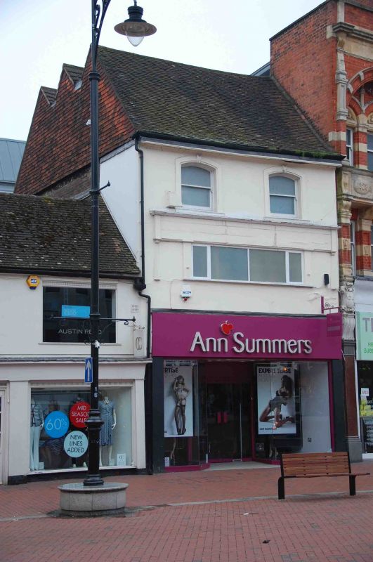
BROAD STREET
1.
5128
(South Side)
No 95
SU 7173 SW 2/414
II
2.
Probably C17 or early C18 in origin. Altered C20. Rendered brick front.
Tiled roof with 3 close set ridges. 2 windows on 2nd floor with segmental
headed late C19 surrounds and window on 1st floor and modern shop front.
Listing NGR: SU7143473437
External links are from the relevant listing authority and, where applicable, Wikidata. Wikidata IDs may be related buildings as well as this specific building. If you want to add or update a link, you will need to do so by editing the Wikidata entry.


Other nearby listed buildings
