Latitude: 51.4547 / 51°27'16"N
Longitude: -0.9738 / 0°58'25"W
OS Eastings: 471401
OS Northings: 173356
OS Grid: SU714733
Mapcode National: GBR QLF.CZ
Mapcode Global: VHDWT.2PKP
Plus Code: 9C3XF23G+VF
Entry Name: Group of four churchyard tombs north of the Church of St Mary
Listing Date: 14 December 1978
Last Amended: 8 January 2024
Grade: II
Source: Historic England
Source ID: 1156950
English Heritage Legacy ID: 39158
ID on this website: 101156950
Location: Reading Minster of St Mary the Virgin, Reading, Berkshire, RG1
County: Reading
Electoral Ward/Division: Abbey
Parish: Non Civil Parish
Built-Up Area: Reading
Traditional County: Berkshire
Lieutenancy Area (Ceremonial County): Berkshire
Church of England Parish: Reading St Mary the Virgin
Church of England Diocese: Oxford
Tagged with: Tomb
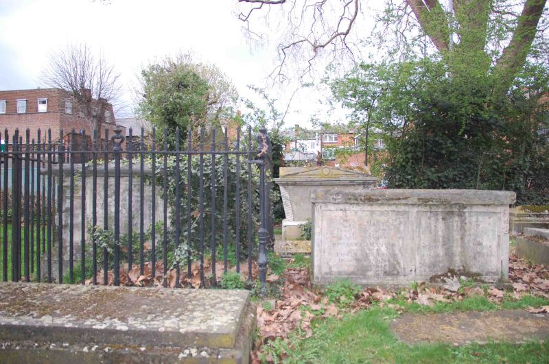
Four burial tombs, erected between the 1730s and 1830s.
Four burial tombs, erected between the 1730s and 1830s.
MATERIALS: all four tombs are faced in a light-grey limestone, probably Portland stone.
DETAILS: the south-western tomb, erected in around 1732, is a large chest tomb with set-back corner pilasters and carved side panels. There are carvings of angels to the western face. It retains cast iron railings with urns on the corner posts.
The south-eastern tomb, erected in around the 1790s, has a cuboidal form with the north and south faces carved with rectangular panels bearing dedications to members of the Martin family.
The north-western tomb is set apart from the others and further away from the church. It was erected in around 1820 and has a moulded top with reeded side piers. It has a wide surround for railings which have been removed.
The north-eastern tomb was erected in around 1830 and is dedicated to John Tappenden. It has pediments to the north and south faces, while the sides have inward-tapered corners with banded, angled piers. The capstone is cross-gabled.
The crossroads formed by the north-south route of St Mary’s Butts/Bridge Street and the east-west route of Gun Street/Castle Street is believed to be the centre of the original Saxon settlement at Reading, established sometime before the ninth century, with the lowest crossing point of the River Kennet lying a short distance away to the south.
Reading was well-established by the time of the Norman Conquest, and the Domesday Book (1086) records six mills and a large estate in the town. The Church of St Mary, which lies on the north-east corner of the crossroads and was mostly rebuilt in 1551-1555, was the town’s primary church until the establishment of Reading Abbey in the C12 and became so again following the dissolution in the late 1530s.
The church and churchyard were extensively restored and ‘improved’ during the late C19, with a row of buildings along the western side of the churchyard demolished to create the open relationship between the churchyard and St Mary’s Butts.
The four churchyard tombs form part of a wider group of elaborate, stone tombs within the churchyard. Collectively, they point to the relative wealth and prosperity of Reading during the C18 and C19 and also record the names of the families and individuals who were prominent in Reading society, during this time.
The group of four churchyard tombs to the north of the Church of St Mary, erected between the 1730s and 1830s, is listed at Grade II for the following principal reasons:
Architectural interest:
* as a late-C18, early-C19 group which contributes to the historic character of the churchyard.
Historic interest:
* as part of the social development of Reading’s ancient core.
Group value:
* the tombs are in close proximity to a large number of listed buildings including the Grade I-listed Church of St Mary.
External links are from the relevant listing authority and, where applicable, Wikidata. Wikidata IDs may be related buildings as well as this specific building. If you want to add or update a link, you will need to do so by editing the Wikidata entry.


Other nearby listed buildings