Approximate Location Map
Large Map »
Latitude: 51.4703 / 51°28'13"N
Longitude: -0.997 / 0°59'49"W
OS Eastings: 469761
OS Northings: 175073
OS Grid: SU697750
Mapcode National: GBR QF8.5C
Mapcode Global: VHDWS.N9SP
Plus Code: 9C3XF2C3+45
Entry Name: The Shanty
Listing Date: 14 December 1978
Grade: II
Source: Historic England
Source ID: 1113602
English Heritage Legacy ID: 39221
ID on this website: 101113602
Location: Reading, Berkshire, RG4
County: Reading
Electoral Ward/Division: Mapledurham
Parish: Non Civil Parish
Built-Up Area: Reading
Traditional County: Oxfordshire
Lieutenancy Area (Ceremonial County): Berkshire
Church of England Parish: Caversham Thameside and Mapledurham
Church of England Diocese: Oxford
Tagged with: Building
1.
5128
SU 67 NE
14/595
THE WARREN
The Shanty
II
2.
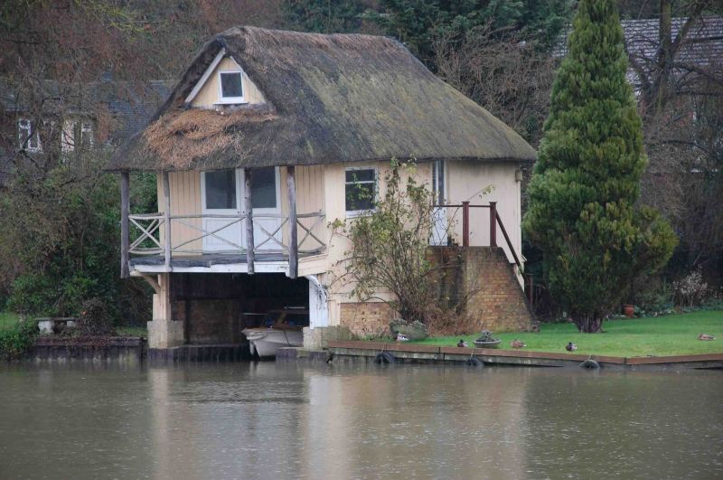
Circa 1905. Boathouse villa. 1 storey attic and basement. Gable end to river.
Weatherboarded and thatched. Watergates with verandah over - rustic wooden
posts with thatch over. Small gable window above.
Listing NGR: SU6976175073
External links are from the relevant listing authority and, where applicable, Wikidata. Wikidata IDs may be related buildings as well as this specific building. If you want to add or update a link, you will need to do so by editing the Wikidata entry.


Other nearby listed buildings
